2. What helpful grocery-store invention rolled out first in Oklahoma City in 1937?
🤯 Mind-Blowing Fact • Grade 2
Oklahoma has more drivable miles of the famous historic highway Route 66 than any other state in America!
✨ Word Sparks (Grade 2 Glossary)
Tap 🔊 to hear
meteorologist
Scientist who studies and forecasts the weather
heritage
Traditions and history passed down through families
highway
Main paved road connecting towns and states
🪝
What two Choctaw words joined together to give Oklahoma its proud name?
1
Rich Native Heritage
Stand on rust-red earth watching scissor-tailed flycatchers swoop through the breeze! Choctaw leader Allen Wright suggested the name 'Oklahoma' from two Choctaw words—'okla' meaning people and 'humma' meaning red. Today, thirty-nine Tribal Nations call Oklahoma home!
2
Land Runs and Statehood
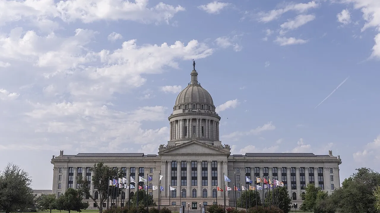
In April 1889, a cannon boomed at noon and thousands of settlers raced on horseback and wagons to claim prairie farms—though sneaky 'Sooners' slipped across the line early! Uniting two territories, Oklahoma became the forty-sixth state on November 16, 1907, with its capital at Oklahoma City.
3
Route 66 and Storm Science
More than four hundred miles of historic Route 66 wind across Oklahoma, while in Norman track storms to keep communities safe!
1. From which Native language do the words 'okla' and 'humma' in Oklahoma's name come?
2. How did Oklahoma get its nickname, 'The Sooner State'?
🤯 Mind-Blowing Fact • Grade 3
Cherokee scholar Sequoyah, who lived near Sallisaw, Oklahoma, created an eighty-five-symbol syllabary that enabled thousands of Cherokee readers to read and write within months!
✨ Word Sparks (Grade 3 Glossary)
Tap 🔊 to hear
panhandle
Narrow strip of land sticking out westward
syllabary
Set of written symbols representing spoken syllables
ecoregion
Area with distinct plants, landforms, and wildlife
🪝
How can one Plains state hold pine forests, ancient granite mountains, salt flats, and tallgrass prairies all at once?
1
Ten Landscapes in One State
Drive across Oklahoma and watch the scenery change ten different times! Pine-covered Ouachita hills in the southeast give way to tallgrass prairies, ancient granite boulders in the Wichita Mountains, gleaming white salt plains, and flat mesas at the tip of the western .
2
Crossroads of Thirty-Nine Tribal Nations
Plains nations including Osage, Comanche, Kiowa, Wichita, Caddo, Pawnee, Cheyenne, and Arapaho peoples lived and hunted across these grasslands. In the 1830s, the federal government forced Cherokee, Chickasaw, Choctaw, Muscogee (Creek), and Seminole families west along the sorrowful Trail of Tears into Indian Territory, where Sequoyah taught the Cherokee writing system.
3
Two Territories Become One State
After the 1889 Land Run opened western Oklahoma Territory, it merged with eastern Indian Territory on November 16, 1907, entering the Union as the forty-sixth state with Oklahoma City becoming its permanent capital in 1910.
4
Doppler Radar Pioneers
Where warm moist Gulf air meets dry western air, Oklahoma scientists in Norman developed Doppler weather radar that saves lives nationwide!
1. What remarkable invention did Cherokee scholar Sequoyah share in Indian Territory?
2. Which two territories united in 1907 to form the State of Oklahoma?
🤯 Mind-Blowing Fact • Grade 4
Fairfax, Oklahoma native Maria Tallchief of the Osage Nation became America's very first major prima ballerina, dazzling audiences from New York City to Paris!
✨ Word Sparks (Grade 4 Glossary)
Tap 🔊 to hear
savanna
Grassland scattered with clumps of sturdy trees
iron
Natural earth mineral turning red when rusted
doppler
Radar method measuring wind speed inside storms
🪝
Why is Oklahoma a world capital for weather science, Indigenous governance, and American arts?
1
Red Permian Soils to Black Mesa
-rich Permian clay colors Oklahoma's central rivers and hillsides a warm brick red! Spanning 69,899 square miles—including a 166-mile-long Panhandle rising to 4,973-foot Black Mesa—Oklahoma ranks among the most ecologically diverse states in America, bridging eastern cypress swamps, Cross Timbers oak , Osage tallgrass prairie, and half-billion-year-old granite domes in the Wichita Mountains Wildlife Refuge.
2
Resilience of Thirty-Nine Sovereign Nations
Following the Indian Removal Act of 1830, Eastern nations endured forced relocation to Indian Territory, rebuilding constitutional governments, printing presses, and schools alongside Plains nations such as the Osage, Comanche, Kiowa, and Pawnee. Today, thirty-nine federally recognized Tribal Nations headquarter in Oklahoma, enriching healthcare, education, law, and cultural preservation across the state.
3
Land Runs, Energy Booms, and Statehood
Beginning April 22, 1889, dramatic land runs turned tent camps into cities like Oklahoma City and Guthrie overnight. Rich underground oil discoveries near Bartlesville and Tulsa ('Oil Capital of the World') fueled rapid growth as Oklahoma entered the Union on November 16, 1907.
4
Weather Radar and Trailblazing Icons
Because warm, humid Gulf of Mexico air collides above the Southern Plains with cool Rocky Mountain air and dry Southwestern winds, Norman's National Weather Center pioneered storm-warning radar! Oklahoma also gave the world Cherokee humorist Will Rogers, Sac and Fox Olympic legend Jim Thorpe, and Osage prima ballerina Maria Tallchief.
1. Why do Oklahoma's famous soils and rivers often glow a warm brick-red color?
2. Which Osage artist from Oklahoma became America's first world-famous prima ballerina?
🤯 Mind-Blowing Fact • Grade 5
Centuries before Europeans arrived, Indigenous traders at Spiro Mounds in eastern Oklahoma gathered Gulf Coast seashells, Great Lakes copper, and turquoise into one of North America's richest ceremonial centers!
✨ Word Sparks (Grade 5 Glossary)
Tap 🔊 to hear
dryline
Weather boundary where moist and dry air collide
biodiversity
Rich variety of plants and wildlife living together
entrepreneurial
Building creative new businesses in a community
🪝
How did ten distinct ecoregions, thirty-nine sovereign Tribal Nations, and colliding continental air masses shape Oklahoma's unique place in American history and atmospheric science?
1
Permian Redbeds, Ancient Orogenies, and Ten Ecoregions
Covering 69,899 square miles from Cypress-tupelo wetlands at 289 feet along the Little River in the southeast to basalt-capped Black Mesa at 4,973 feet at the western tip of the Cimarron Strip (Panhandle), Oklahoma encompasses more ecoregions per square mile than almost any other state. Iron-rich Permian shales color central valleys crimson, flanked by the folded sandstone ridges of the Ouachita Mountains, the eroded 500-million-year-old Cambrian granite peaks of the Wichita Mountains, the post-oak Cross Timbers dividing eastern woodlands from western plains, and the Joseph H. Williams Tallgrass Prairie Preserve where thousands of free-ranging bison restore prairie .
2
Indigenous Crossroads, Sequoyah's Syllabary, and Sovereign Resilience
Ancestral Spiro Mound builders along the Arkansas River traded copper, conch shells, and ceremonial pottery across pre-contact North America, followed by Plains Wichita, Caddo, Osage, Pawnee, Comanche, and Kiowa nations. During the 1830s, federal removal forced the Cherokee, Chickasaw, Choctaw, Muscogee (Creek), and Seminole nations along the Trail of Tears into Indian Territory, followed later by dozens of relocated Plains, Midwest, and Western tribes. Despite immense hardship, tribal citizens rebuilt constitutional republics, bilingual academies, and Sequoyah's Cherokee-language press; in 1866, Choctaw Principal Chief Allen Wright proposed 'Oklahoma' ('okla humma'). Today, thirty-nine federally recognized Tribal Nations exercise dynamic sovereignty across the state.
3
Unassigned Lands, Twin Territories, and 1907 Statehood
On April 22, 1889, fifty thousand homesteaders surged into the central Unassigned Lands, establishing Guthrie and Oklahoma City in hours. Though Indigenous delegates at the 1905 Sequoyah Convention proposed separate statehood for Indian Territory, Congress combined Oklahoma Territory and Indian Territory under the Enabling Act of 1906, admitting Oklahoma as the forty-sixth state on November 16, 1907, and moving the capital to Oklahoma City in 1910.
4
Tulsa Resilience, Energy History, and Route 66
Early twentieth-century petroleum strikes like the 1905 Glenn Pool propelled Oklahoma's economy, while Tulsa's Greenwood District—remembered and honored after the tragic 1921 Tulsa Race Massacre—exemplified Black achievement. Opened in 1926 and championed by Oklahoman Cyrus Avery, U.S. Highway 66 ('The Mother Road') traced more than four hundred vibrant miles through Tulsa, Oklahoma City, and Clinton.
5
Atmospheric Physics and Cultural Trailblazers
Positioned along the '' where moist Gulf of Mexico air masses meet arid Southwestern and cool Rocky Mountain air, Norman's National Weather Center and NOAA National Severe Storms Laboratory pioneered pulsed Doppler weather radar and phased-array storm forecasting, complementing cultural icons Will Rogers, Jim Thorpe, Woody Guthrie, Ralph Ellison, and Osage prima ballerina Maria Tallchief.