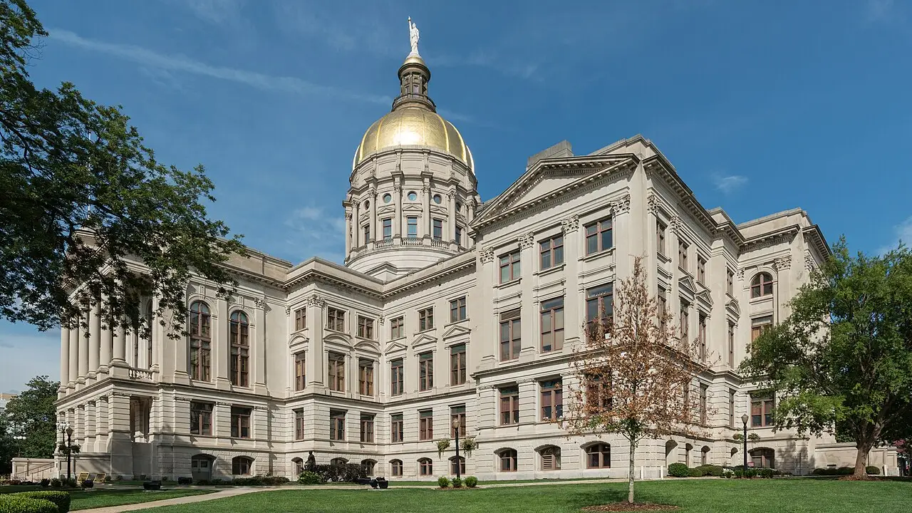
⚡ Historical SparkLargest state east of the Mississippi River by land area and birthplace of civil rights icon Dr. Martin Luther King Jr.
🤯 Mind-Blowing Fact • Grade 1
Georgia farmers grow almost half of all the peanuts used to make yummy peanut butter in the United States!
✨ Word Sparks (Grade 1 Glossary)
Tap 🔊 to hear
clay
Fine, sticky earth that holds water tightly
blossom
Flower on a tree before fruit grows
swamp
Forested wetland where trees stand in water
🪝
Where do fuzzy sweet peaches grow above bright red clay dirt?
1
Juicy Orchards and Red Earth
Take a bite of a warm, sweet summer peach! Across sunny Georgia hills, green trees grow in rusty-red soil. Brown thrashers sing happy songs from blooming white Cherokee roses.
2
Busy Atlanta
Atlanta is the bustling state capital. Planes from all around the world land and take off at its giant airport!
3
Mossy Coastal Oaks
Near the Atlantic Ocean, lacy gray moss hangs from giant live oak trees in historic Savannah.
1. Which sweet summer fruit gives Georgia its famous nickname?
2. What is the capital city of the State of Georgia?
🤯 Mind-Blowing Fact • Grade 2
Savannah, Georgia, was designed in 1733 as America's first planned city of shady neighborhood garden squares, twenty-two of which still welcome walkers today!
✨ Word Sparks (Grade 2 Glossary)
Tap 🔊 to hear
colony
Early settlement ruled by a distant country
pecan
Smooth-shelled nut grown on tall southern trees
trailhead
Starting spot where a hiking trail begins
🪝
Where does a two-thousand-mile mountain footpath begin its long journey north?
1
First Step on the Appalachian Trail
Lace up your hiking boots atop misty Springer Mountain in northern Georgia! Right here begins the famous Appalachian Trail, winding more than two thousand miles north all the way to Maine.
2
Youngest Colony, Fourth State
Founded in 1733 along the Savannah River with neat shady park squares, Georgia was the youngest of the original thirteen colonies. On January 2, 1788, it became the fourth state to approve the U.S. Constitution.
3
Swamps, Peanuts, and Leaders
Southern Georgia holds the giant Okefenokee Swamp and sunny farms growing peanuts and . In Atlanta, Dr. Martin Luther King Jr. grew up inspiring kindness, peace, and equal rights.
1. Which famous civil rights leader was born and raised in Atlanta, Georgia?
2. Which long hiking path starts on Springer Mountain in northern Georgia?
🤯 Mind-Blowing Fact • Grade 3
Georgia leads the nation not only in peanuts and pecans, but also in sweet Vidalia onions grown in low-sulfur soil that keeps them from making cooks cry!
✨ Word Sparks (Grade 3 Glossary)
Tap 🔊 to hear
piedmont
Rolling foothills between mountains and flat coast
peat
Spongy wetland layer of partly decayed plants
junction
Meeting point where railroad tracks cross together
🪝
Why is Georgia's soil bright rusty-red, and what makes the Land of the Trembling Earth shake?
1
Secret of Georgia's Red Clay
Scoop up a handful of soil in Georgia's hilly region and see why it glows brick-red! Warm rain and humid air slowly rusted natural iron minerals inside weathered rocks—just like rain rusts an iron bicycle left outdoors.
2
Trembling Earth in the Okefenokee
Down on Georgia's southern border stretches the vast Okefenokee Swamp. Its Native American name means 'Land of the Trembling Earth' because thick mats of floating moss wobble underfoot even when shrubs and small cypress trees sprout on top!
3
Largest State East of the Mississippi
Founded by James Oglethorpe at Savannah in 1733 and ratified as the fourth state on January 2, 1788, Georgia covers more land area than any other state east of the Mississippi River.
4
Crossroads of Rails, Planes, and Presidents
Atlanta began in the 1830s as a railroad and grew into home of the world's busiest passenger airport, while tiny Plains, Georgia, raised thirty-ninth U.S. President Jimmy Carter.
1. What natural mineral gives Georgia's Piedmont clay its famous rusty-red color?
2. Which thirty-ninth President of the United States grew up on a peanut farm near Plains, Georgia?
🤯 Mind-Blowing Fact • Grade 4
Cherokee scholar Sequoyah's remarkable reading and writing system enabled thousands of Cherokee citizens in Georgia and neighboring areas to read and print a bilingual newspaper within just a few years!
✨ Word Sparks (Grade 4 Glossary)
Tap 🔊 to hear
syllabary
Writing symbols standing for spoken word syllables
barrier
Offshore sandy island shielding mainland from waves
sediment
Sand, mud, or shells settled by water
🪝
How do five distinct geographic provinces—from Appalachian peaks to Golden Isles barrier beaches—shape life across Georgia?
1
Five Landscapes Across the Fall Line
Travel from Georgia's northern corners to its Atlantic coast and you cross five distinct geographic provinces: the Appalachian Plateau, Ridge and Valley, Blue Ridge Mountains (peaking at 4,784-foot Brasstown Bald), rolling Piedmont hills, and the broad Coastal Plain. Cutting right through Columbus, Macon, and Augusta runs the Fall Line—an ancient prehistoric shoreline where rocky Piedmont rivers tumble over rapids onto soft coastal , inspiring water-powered textile mills.
2
Indigenous Legacy and Sequoyah's Syllabary
Centuries before English colonists landed at Yamacraw Bluff in 1733, Mississippian builders raised flat-topped mounds at Etowah and Ocmulgee, followed by Muscogee (Creek) and Cherokee towns. By 1821, Cherokee silversmith Sequoyah completed an eighty-six-character representing spoken Cherokee syllables, enabling the Cherokee Phoenix newspaper to be printed at New Echota in northern Georgia.
3
Fourth State to Ratify the Constitution
Eager for federal support along its frontier, Georgia voted unanimously on January 2, 1788, to become the fourth state—and the very first southern state—to ratify the U.S. Constitution.
4
Barrier Islands and Global Aviation
Along Georgia's hundred-mile coast, salt marshes behind the Golden Isles islands shield the mainland from storm waves and nurture shrimp and loggerhead sea turtles, while inland Atlanta connects global flights, universities, and film studios.
1. Why did cities like Columbus, Macon, and Augusta grow along Georgia's Fall Line?
2. What major cultural breakthrough was printed at New Echota in northern Georgia starting in 1828?
🤯 Mind-Blowing Fact • Grade 5
Deep along Georgia's Fall Line lies the world's richest belt of pure white kaolin clay—formed from ancient weathered minerals and used to make everything from fine porcelain dishes to glossy magazine pages!
✨ Word Sparks (Grade 5 Glossary)
Tap 🔊 to hear
monadnock
Isolated hard rock hill resisting surrounding erosion
estuarine
Relating to tidal marshes mixing salt and fresh
terminus
Ending station at the tip of a railroad
🪝
What links crystalline monadnocks, salt-marsh tidal amplitude, 1788 constitutional ratification, and modern civil rights leadership in the Empire State of the South?
1
Crystalline Uplands, Stone Mountain, and Coastal Tides
Encompassing 59,425 square miles—the largest land area east of the Mississippi River—Georgia descends from the ancient metamorphic peaks of the Blue Ridge across the weathered Piedmont to the Atlantic Coastal Plain. East of Atlanta rises Stone Mountain, a massive quartz-monzonite pluton (or ) formed roughly 300 million years ago when molten magma cooled miles underground before softer surrounding rock eroded away. Along the Atlantic shore, Georgia's concave coastline funnels twice-daily six-to-nine-foot tides across nearly 400,000 acres of Spartina cordgrass salt marshes behind fourteen barrier islands—one-third of all salt marshes on the U.S. East Coast.
2
Mississippian Chiefdoms, Trusteeship, and Fourth Statehood
Archaeological earthworks at Ocmulgee Mounds near Macon document over twelve millennia of continuous human presence along the Fall Line. Chartered in 1732 and settled in 1733 by General James Oglethorpe after diplomacy with Yamacraw leader Tomochichi and interpreter Mary Musgrove, Georgia was the thirteenth British Atlantic colony. On January 2, 1788, delegates in Augusta voted 26–0 to ratify the U.S. Constitution, making Georgia the fourth state.
3
From Railroad Terminus to Global Logistics
Founded in 1837 as ''—the zero-milepost southern end of the Western and Atlantic Railroad—Atlanta grew atop a continental drainage divide into the transportation hub of the Southeast. Today, Hartsfield-Jackson Atlanta International Airport serves roughly one hundred million passengers annually, paired with the deepwater Port of Savannah.
4
Birthplace of Nonviolent Civic Transformation
Atlanta's Sweet Auburn historic district, centered around Ebenezer Baptist Church and historically Black colleges including Morehouse and Spelman, nurtured Dr. Martin Luther King Jr. and key civic institutions that reshaped twentieth-century American constitutional equality, while Plains native Jimmy Carter later won the Nobel Peace Prize.
5
Forestry, Kaolin, and Diverse Agriculture
Beyond leading national harvests of peanuts, pecans, blueberries, and broiler poultry, Georgia's Fall Line mines white kaolin clay essential for glossy paper, ceramics, and advanced coatings, while sustainable pine forests blanket millions of acres.