⚡ Historical SparkLargest U.S. state by area—more than twice the size of Texas—and home to North America's tallest mountain
🤯 Mind-Blowing Fact • Grade 1
Alaska is so huge that you could fit Texas inside it more than two times with room to spare!
✨ Word Sparks (Grade 1 Glossary)
Tap 🔊 to hear
glacier
A giant, slow-moving river of thick ice
peak
The very top point of a mountain
salmon
A strong fish that swims upstream
🪝
Where can you see green ribbons of light dance across the night sky?
1
Land of Big Snow
Look up at green and purple lights glowing in the dark winter sky! Welcome to Alaska, our biggest state. Huge rivers of ice called slide down snowy mountains.
2
Tallest Peak and Wild Bears
High in the clouds stands Denali, the tallest mountain in North America. Brown bears catch jumping in cold, clear streams.
3
A Boat or Plane Capital
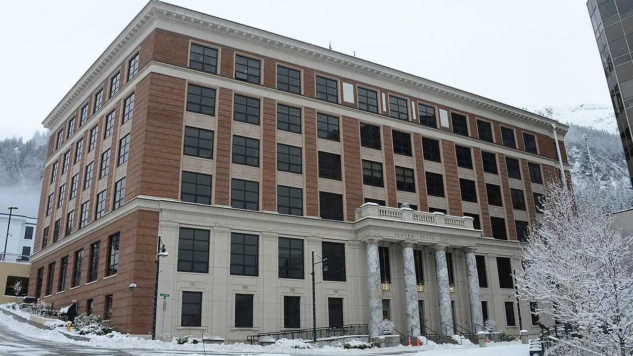
Juneau is the state capital. No highways reach Juneau, so visitors arrive by boat or airplane!
1. How do visitors travel to Alaska's capital city of Juneau?
2. What is the name of North America's tallest mountain, located in Alaska?
🤯 Mind-Blowing Fact • Grade 2
Alaska has more coastline than all the other forty-nine U.S. states combined!
✨ Word Sparks (Grade 2 Glossary)
Tap 🔊 to hear
aurora
Colorful natural lights glowing in polar skies
coastline
The curving edge where land meets sea
musher
A driver who guides a dog sled
🪝
What happens in a place where summer days stay bright even at midnight?
1
The Forty-Ninth State
Hear the call to their sled dogs racing across crisp white snow! Alaska joined the United States as the forty-ninth state on January 3, 1959. It sits far to the northwest, separated from the lower forty-eight states by Canada.
2
Midnight Sun and Northern Lights
In northern Alaska, the summer sun shines all day and night without setting! In winter, shimmering curtains of green light called the borealis glow overhead.
3
Oceans, Mountains, and First Peoples
Three oceans touch Alaska's rugged coast, where whales, sea otters, and bald eagles live. Alaska Native peoples have fished, carved, and thrived here for thousands of years.
1. Which country sits between Alaska and the lower forty-eight U.S. states?
2. What unusual thing happens in northern Alaska during the middle of summer?
🤯 Mind-Blowing Fact • Grade 3
The historic 1925 serum run saw relay teams of sled dogs brave howling blizzards across 674 miles to deliver lifesaving medicine to Nome, Alaska!
✨ Word Sparks (Grade 3 Glossary)
Tap 🔊 to hear
tundra
Cold, treeless land with frozen ground underneath
fjord
A narrow sea inlet between steep cliffs
permafrost
Ground that stays frozen all year long
🪝
Why did people once laugh when the United States bought Alaska, only to discover a treasure chest of wonders?
1
A Bargain Called Seward's Folly
Crack! A towering wall of blue ice calves off a glacier and splashes into an icy . In 1867, U.S. Secretary of State William Seward arranged to buy Alaska from Russia for two cents an acre. Critics joked it was a frozen wasteland, yet Alaska proved rich in gold, fish, timber, and oil.
2
Land of Giants
Admitted as the forty-ninth state in 1959, Alaska covers 665,384 square miles. Inside Denali National Park rises Denali, reaching 20,310 feet above sea level. Grizzly bears, moose, caribou herds, and wolves roam its vast and boreal forests.
3
Alaska Native Traditions
Indigenous peoples—including the Inupiat, Yup'ik, Aleut, Athabascan, Tlingit, and Haida—crafted waterproof kayaks, towering cedar totem poles, and warm parkas suited to subarctic weather.
4
Juneau, Bush Planes, and Sled Trails
Because mountains, islands, and limit roads, pilots fly sturdy bush planes to remote villages, including routes near the capital city of Juneau and historic Iditarod sled trails.
1. From which country did the United States purchase Alaska in 1867?
2. How high does Denali rise above sea level?
🤯 Mind-Blowing Fact • Grade 4
Tongass National Forest in southeastern Alaska protects nearly seventeen million acres of temperate coastal rainforest filled with towering Sitka spruce and western hemlock trees!
✨ Word Sparks (Grade 4 Glossary)
Tap 🔊 to hear
archipelago
A long chain or group of islands
subarctic
Region just south of the Arctic Circle
tectonic
Related to giant moving plates of Earth
🪝
How does Earth's tilt, tectonic power, and Arctic geography shape life across America's largest state?
1
Where Three Seas and Continents Nearly Touch
Stand on a windy bluff overlooking the Bering Strait, where Alaska's mainland sits just fifty-five miles from Asia, and between two tiny islands the gap narrows to less than three miles! Bordered by the Pacific Ocean, Bering Sea, and Arctic Ocean, Alaska became the forty-ninth U.S. state on January 3, 1959, nearly a century after the $7.2 million Alaska Purchase of 1867.
2
Volcanoes, Glaciers, and Denali
Along southern Alaska and the sweeping Aleutian Island chain, the Pacific plate plunges beneath the North American plate. That collision pushes up Denali to 20,310 feet and fuels more than forty active volcanoes along the Pacific Ring of Fire. Meanwhile, heavy snowfall feeds roughly 100,000 glaciers that carve deep valleys and fjords.
3
Tundra Adaptations and Indigenous Ingenuity
North of the Brooks Range stretches Arctic tundra underlain by permafrost. Because tree roots cannot penetrate frozen subsoil, low mosses, lichens, and dwarf willows carpet the ground. For millennia, Alaska Native communities engineered ocean-going skin boats, insulated sod homes, and cedar plank architecture tuned to coastal rainforests and icy seas.
4
Modern Connections Across Wild Terrain
From the roadless capital of Juneau in the Tongass National Forest—America's largest national forest—to the 800-mile Trans-Alaska Pipeline engineered on elevated supports so warm oil will not melt permafrost, Alaskans solve tough geographic challenges every day.
1. Why is much of the Trans-Alaska Pipeline built up on supports above the ground?
2. Why does southern Alaska have both North America's tallest peaks and dozens of active volcanoes?
🤯 Mind-Blowing Fact • Grade 5
Bering Glacier in southeastern Alaska is the largest glacier in North America, covering roughly two thousand square miles with ice up to half a mile thick!
✨ Word Sparks (Grade 5 Glossary)
Tap 🔊 to hear
non-contiguous
Not sharing a connected border with neighbors
subduction
One Earth plate sliding beneath another plate
taiga
Vast northern forest of spruce and pine
🪝
What makes a non-contiguous peninsula spanning twenty degrees of latitude a living laboratory of geology, climate, and human resilience?
1
Beringia and Ten Thousand Years of Stewardship
During the Pleistocene Ice Ages, lower sea levels exposed Beringia—a thousand-mile-wide grassland land bridge linking Siberia and Alaska—allowing ancient peoples and Ice Age megafauna to cross into the Americas. Over thousands of years, diverse Indigenous nations flourished across distinct ecological zones: Tlingit and Haida master carvers in the temperate Tongass rainforest, Unangax̂ (Aleut) mariners across the Aleutian archipelago, Athabascan hunters in the interior boreal , and Yup'ik and Iñupiat communities along the Bering and Arctic coasts.
2
From Russian Treaty to Forty-Ninth State
Following eighteenth-century Russian fur-trading expeditions led by Vitus Bering, the United States acquired the 586,412-square-mile land area of Alaska in the 1867 Treaty of Cession negotiated by Secretary of State William H. Seward for $7.2 million. Klondike and Nome gold rushes in the late 1890s, World War II construction of the Alaska Highway, and territorial advocacy culminated on January 3, 1959, when President Dwight D. Eisenhower signed the proclamation admitting Alaska as the forty-ninth state, with Juneau serving as capital.
3
Subduction Tectonics and Cryospheric Scale
Geologically, southern Alaska sits atop an active convergent boundary where the Pacific Plate subducts northward at roughly five to seven centimeters per year. This immense crustal compression uplifted the Alaska Range—crowned by 20,310-foot Denali—and powers over eighty percent of the active volcanoes in the United States. Extensive glacial systems, such as the Hubbard and Bering glaciers, store vast reserves of fresh water.
4
Solar Geometry and Magnetospheric Skies
Because one-third of Alaska lies north of the Arctic Circle at 66.5° N latitude, Utqiaġvik experiences more than eighty consecutive days of uninterrupted summer daylight and over sixty winter days of polar twilight. Charged solar particles guided by Earth's magnetic field collide with upper-atmosphere oxygen and nitrogen to ignite vivid aurora borealis displays.
5
Resource Conservation and Stewardship
Today, Alaska balances wild-caught Pacific salmon fisheries, mineral and energy resources managed alongside the Alaska Permanent Fund, and more than fifty million acres of national parks that safeguard migratory caribou, humpback whales, and brown bears.