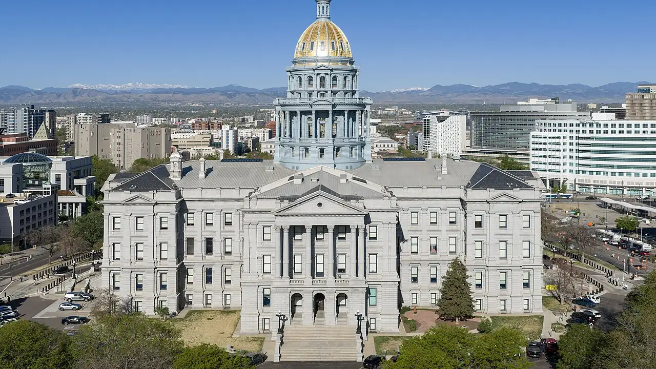
1. Which city is the Mile High capital of the State of Colorado?
2. Which giant mountain range runs right through Colorado?
🤯 Mind-Blowing Fact • Grade 2
Great Sand Dunes National Park in southern Colorado holds the tallest sand dunes in North America, piled right against snowy mountains!
✨ Word Sparks (Grade 2 Glossary)
Tap 🔊 to hear
centennial
A celebration marking one hundred full years
mesa
A high, flat-topped hill with steep sides
alcove
A sheltered cave-like hollow in a cliff
🪝
Why did Colorado earn the birthday nickname the Centennial State?
1
A Hundred-Year Celebration
Hear the bugle of an elk echoing across a mountain meadow! Colorado joined the United States on August 1, 1876, as the thirty-eighth state. Because 1876 was one hundred years after America's birthday in 1776, people named it the State.
2
Homes Inside Canyon Walls
Long ago at Verde in southwestern Colorado, Ancestral Puebloan families built multi-story stone homes tucked safely inside giant sandstone !
3
Purple Mountain Majesties
From the top of Pikes Peak, sweeping views of golden plains and purple mountains inspired the beloved song 'America the Beautiful.'
1. Why is Colorado nicknamed the Centennial State?
2. Which Colorado mountain view inspired the words to 'America the Beautiful'?
🤯 Mind-Blowing Fact • Grade 3
Colorado is one of only two U.S. states—along with Wyoming—whose map borders form a nearly neat four-sided rectangle of latitude and longitude lines!
✨ Word Sparks (Grade 3 Glossary)
Tap 🔊 to hear
divide
High mountain ridge separating river flow directions
headwaters
Mountain streams where a big river begins
elevation
Height of land measured above sea level
🪝
How can two raindrops falling inches apart in Colorado end up in two completely different oceans?
1
Splitting Waters on the Continental Divide
Stand on a windy ridge high in Rocky Mountain National Park as snowflakes swirl onto your jacket! Along this invisible line—called the Continental —melted snow on the western slope flows toward the Pacific Ocean, while snow on the eastern slope flows toward the Gulf of Mexico and Atlantic Ocean.
2
Mother of Rivers and Fifty-Eight Fourteeners
Because mighty rivers like the Colorado, Rio Grande, Arkansas, and South Platte begin in its snowy peaks, geographers call Colorado the 'Mother of Rivers.' Fifty-eight Colorado summits—led by 14,440-foot Mount Elbert—rise higher than 14,000 feet!
3
Cliff Palace at Mesa Verde
More than seven hundred years ago, Ancestral Puebloan masons shaped sandstone blocks into Cliff Palace at Mesa Verde National Park, building 150 rooms beneath an overhanging canyon ledge.
4
Plains, Ranches, and Mile-High Denver
East of Denver, the state capital, flat shortgrass prairies stretch toward Kansas, growing wheat, corn, and cattle.
1. What happens to water falling on opposite sides of the Continental Divide in Colorado?
2. What do hikers in Colorado call the fifty-eight mountains that rise above 14,000 feet?
🤯 Mind-Blowing Fact • Grade 4
Colorado's lowest elevation point on its eastern border is still higher above sea level than the tallest mountain peak in eighteen other states!
✨ Word Sparks (Grade 4 Glossary)
Tap 🔊 to hear
alpine
High mountain zone above the tree line
fossil
Preserved remains or traces of ancient life
sandstone
Layered rock formed from cemented sand grains
🪝
Why does America's highest-elevation state supply lifeblood water to millions of people across the West?
1
Roof of the American Continent
With an average elevation of 6,800 feet above sea level, no other U.S. state sits higher than Colorado! Even its lowest point—where the Arikaree River crosses into Kansas at 3,317 feet—is higher than the tallest mountain peak in eighteen other states. Admitted as the thirty-eighth state on August 1, 1876, Colorado takes its name from a Spanish word meaning 'colored red,' inspired by rusty canyons like Garden of the Gods.
2
Snowpack That Quenches Seven States
High in Rocky Mountain National Park, winter storms pile deep snow above the Continental Divide. When spring sunshine melts that snowpack, cold streams feed the headwaters of the Colorado River, supplying drinking water and farm irrigation to roughly forty million people across seven southwestern states and Mexico.
3
Ancient Dinosaurs and Puebloan Architecture
Near Morrison and Dinosaur Ridge, tilted sedimentary layers revealed some of the world's first Stegosaurus —now Colorado's state fossil! Farther southwest, Ute, Cheyenne, and Arapaho peoples traversed lands where Ancestral Puebloans had engineered communities at Mesa Verde.
4
From Silver Booms to Space Science
Nineteenth-century gold and silver discoveries sparked mountain rail towns and built Denver into a regional hub. Today, Denver, Boulder, and Colorado Springs lead atmospheric research, renewable energy labs, and spacecraft engineering.
1. Which plated plant-eating dinosaur is the official state fossil of Colorado, first unearthed near Morrison?
2. Roughly how many people across the Southwest rely on water starting in the Colorado River watershed?
🤯 Mind-Blowing Fact • Grade 5
Because nineteenth-century surveyors left tiny zigzags between stone boundary markers that remain legally official, 'rectangular' Colorado actually has 697 sides!
✨ Word Sparks (Grade 5 Glossary)
Tap 🔊 to hear
orogeny
Geological process that folds and lifts mountains
allocation
Carefully measured share of a shared resource
quadrilateral
Geometric shape bounded by four straight sides
🪝
How did Laramide mountain building, radial river basins, and 697 boundary markers shape the Centennial State?
1
Laramide Uplift and Three Physiographic Provinces
Spanning 104,094 square miles between 37° N and 41° N latitude, Colorado divides neatly into three major physiographic regions: the eastern High Plains, the central Southern Rocky Mountains, and the western Colorado Plateau. Roughly seventy to forty million years ago, the Laramide buckled deep Precambrian granite upward through overlying marine shales and red sandstones, thrusting up fifty-eight summits exceeding 14,000 feet while tilting dramatic hogback ridges like Red Rocks and Garden of the Gods.
2
Radial Headwaters and Interstate Compacts
Because no major rivers flow into Colorado while four major river systems—the Colorado, Rio Grande, Arkansas, and Platte—originate inside its alpine snowfields, hydrologists describe Colorado as a radial watershed hub. Managing scarce western water led to the landmark 1922 Colorado River Compact, dividing river between Upper and Lower Basin states, alongside trans-mountain tunnels bored beneath the Continental Divide to serve Front Range cities.
3
Indigenous Legacy and 1876 Statehood
For centuries, Ancestral Puebloans cultivated maize on southwestern mesas before migrating southward around 1300 CE, while Ute bands inhabited mountain valleys and Cheyenne and Arapaho nations hunted bison on the eastern plains. Following the 1858–1859 Pike's Peak Gold Rush, Congress organized Colorado Territory in 1861 and admitted the thirty-eighth state on August 1, 1876—the centennial year of the Declaration of Independence.
4
Why a 'Rectangle' Actually Has 697 Sides
Although maps show Colorado as a crisp bounded by latitude and longitude lines, nineteenth-century surveyors working over rugged 14,000-foot peaks with chains and compasses left tiny zigzags. Modern GPS measurements confirm those historic boundary stones remain legally binding—giving Colorado 697 distinct straight-line sides!
5
Atmospheric, Timekeeping, and Aerospace Science
Today, Denver and Boulder host the National Center for Atmospheric Research and the NIST atomic clock that keeps official civilian time for the entire United States.