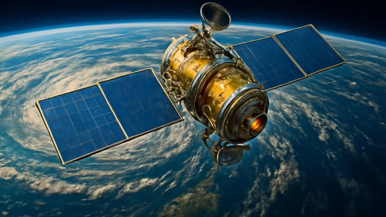
The very first weather satellite was called TIROS-1 and launched in 1960.
✨ Word Sparks (Grade 2 Glossary)
Tap 🔊 to hear
scientist
A person who studies and learns about things
hurricane
A very big, strong storm
camera
A tool that takes pictures
🪝
Have you ever wondered how we know when a big storm is coming?
1
Satellites Circle the Earth
Weather satellites travel high above our planet. They move in circles called orbits and never touch the ground. These machines are built to last and work in space.
2
Watching Clouds and Storms
The satellites use special to take pictures of clouds. They send these pictures to on Earth, who study them to find out where storms are moving.
3
Helping People Stay Safe
When see a storm, they can warn people early. This helps families prepare for rain, snow, or . Weather satellites help keep everyone safe and ready.
Some weather satellites orbit 22,000 miles above Earth—almost three times deeper than airplanes fly!
✨ Word Sparks (Grade 3 Glossary)
Tap 🔊 to hear
sensor
A tool that detects things
orbit
The path something takes around Earth
prediction
A guess about what will happen
🪝
Imagine hearing a storm warning before you even see a cloud—how do we do that?
1
Satellites: Earth’s Weather Helpers
Weather satellites high above Earth, circling the globe every day. Their special can see clouds, storms, and even snow from space. These satellites send information to scientists using radio waves. This helps us know what weather is coming.
2
How Satellites Work
Satellites use cameras and to capture images and data. They measure things like cloud shape, wind speed, and temperature from far away. The information travels quickly back to Earth. Scientists use computers to study the data and make weather .
3
Tracking Storms and Disasters
When a hurricane forms, satellites track its movement across the ocean. They can see the swirling clouds and measure the storm’s strength. This helps warn people before the storm arrives. Early warnings save lives and protect homes.
4
A Big Impact Around the World
Weather satellites help every country, not just one. They share data with scientists everywhere to improve forecasts. These inventions help us prepare for floods, droughts, and even wildfires. Satellites make the world a safer place.
Modern weather satellites can measure tiny changes in sea level from space to help predict floods.
✨ Word Sparks (Grade 4 Glossary)
Tap 🔊 to hear
infrared
A type of light we cannot see
meteorologist
A scientist who studies weather
forecast
A prediction of what the weather will be
🪝
What if you could watch a hurricane swirl across the ocean from space?
1
Satellites: Eyes Above Our World
Weather satellites are advanced inventions that orbit Earth, collecting data about our atmosphere. Their sensors detect cloud patterns, wind speeds, and temperatures from thousands of miles above. These satellites use radio transmitters to send information to ground stations. Scientists rely on this data to monitor and predict weather events.
2
How Weather Satellites Work
Satellites use sophisticated cameras and sensors to capture detailed images of Earth. They can measure the temperature of clouds and track moisture in the air. Some satellites remain in a fixed position over one spot, while others circle the planet many times a day. This constant observation helps make accurate .
3
Protecting People and Places
When dangerous storms like hurricanes or blizzards form, satellites provide early warnings to communities. Their data helps emergency teams prepare and respond quickly, reducing the risk of harm. Satellites also help track wildfires, floods, and droughts by monitoring changes in the environment. This technology saves lives and protects property worldwide.
4
A Global Team Effort
Weather satellites are used by countries all over the world, sharing information to improve global . International cooperation allows scientists to study climate change and extreme weather together. These inventions have transformed how we understand and respond to nature’s power. Thanks to satellites, we are better equipped to face the world’s wildest weather.
Some modern weather satellites can detect lightning flashes from space and track over 1,000 storms at once.
✨ Word Sparks (Grade 5 Glossary)
Tap 🔊 to hear
geostationary
A satellite that stays over one spot
radiometer
A tool that measures energy from Earth
microwave
A type of invisible energy used in science
🪝
Imagine you could watch a tornado form from space—what technology makes that possible?
1
Weather Satellites: Engineering Marvels in Orbit
Weather satellites are complex machines engineered to orbit Earth and gather atmospheric data from space. They are launched into either or polar orbits, depending on their mission requirements. Geostationary satellites remain fixed over one location, while polar-orbiting satellites scan the entire planet as Earth rotates. These satellites are equipped with advanced sensors that detect visible, infrared, and radiation, enabling them to monitor cloud cover, temperature, and humidity globally.
2
How Satellites Collect and Transmit Data
Onboard instruments such as , spectrometers, and cameras continuously capture high-resolution images and measure energy emitted from Earth’s surface and atmosphere. The data is converted into digital signals and transmitted to ground stations using powerful radio antennas. Meteorologists process this information with sophisticated computer models to create accurate forecasts, track severe storms, and study climate patterns.
3
Historical Evolution and Key Milestones
The first weather satellite, TIROS-1, was launched by NASA in 1960, revolutionizing meteorology by providing real-time cloud images. Since then, satellite technology has advanced rapidly, with modern satellites capable of measuring wind speeds, ocean temperatures, and even soil moisture. International programs like NOAA’s GOES and Europe’s Meteosat have expanded global coverage, allowing for near-constant observation of Earth’s weather systems.
4
Global Impact and Scientific Importance
Weather satellites play a crucial role in disaster preparedness, enabling early warnings for hurricanes, tornadoes, droughts, and floods. Their data is essential for aviation, agriculture, shipping, and emergency management worldwide. By monitoring long-term changes, satellites also help scientists understand climate change, track melting ice, and predict future environmental challenges.
5
Engineering Challenges and Future Innovations
Building weather satellites requires solving complex engineering problems, such as shielding sensitive electronics from radiation and ensuring precise orientation in orbit. Future satellites may use artificial intelligence to analyze data in real time and deploy swarms of small sensors for even more detailed observations. As technology evolves, weather satellites will continue to be humanity’s eyes in the sky, safeguarding lives and unlocking new scientific discoveries.