🇺🇸 U.S. HISTORY
🏛️ 35th U.S. State • The Mountain State
VA History & Social Science SOL K.1, 1.2, 2.4, VS.1–VS.10, USI & USII
State of West Virginia
Mountain Ridges, Deep Gorges, and Listening Telescopes
Grade 1 • Early Reader • 60 words
⏳ Era / StatehoodStatehood: June 20, 1863 (35th State)
🗺️ Region / CapitalAppalachian / Mid-Atlantic South • Capital: Charleston
📜 Key MilestoneNew River Gorge National Park, Harpers Ferry river confluence, and Green Bank Radio Telescope
⚡ Historical SparkOnly state lying completely inside the Appalachian Mountain region—born in 1863 to stay in the Union
🤯 Mind-Blowing Fact • Grade 1
Every crisp yellow Golden Delicious apple in grocery stores around the world comes from one chance seedling tree discovered on a farm in Clay County, West Virginia, in 1905!
✨ Word Sparks (Grade 1 Glossary)
Tap 🔊 to hear
gorge
deep narrow canyon with a rushing river
arch
strong curved shape supporting a tall bridge
seedling
young baby tree sprouted from a seed
🪝
Why is West Virginia called the Mountain State?
1
Hills in Every Direction
Climb a green trail and look all around! Every single part of West Virginia sits inside the rolling Appalachian Mountains.
2
Bridge Over a Deep Canyon
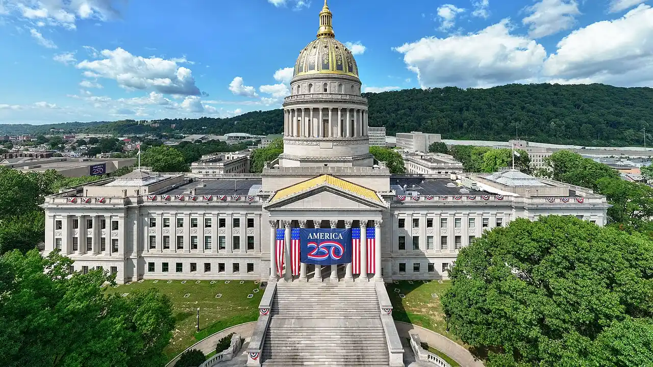
Rushing white water foams far below a giant steel bridge at New River . Gold domes shine in Charleston, the capital city!
3
Sweet Golden Apples
Crisp yellow Golden Delicious apples first grew on a family hillside farm right here in West Virginia!
1. Why did West Virginia earn the nickname 'The Mountain State'?
2. Which famous yellow apple variety was first discovered on a West Virginia farm?
🤯 Mind-Blowing Fact • Grade 2
Despite being named the 'New River,' scientists estimate the river carving New River Gorge is hundreds of millions of years old—older than the Appalachian peaks around it!
✨ Word Sparks (Grade 2 Glossary)
Tap 🔊 to hear
rapids
fast bumpy river water rushing over rocks
Union
states united together under one national government
gap
low pass cut through a mountain ridge
🪝
How can a river called the 'New River' actually be one of the oldest rivers on Earth?
1
An Ancient River Flowing North
Listen to whitewater roar nearly nine hundred feet below the soaring steel arch of the New River Gorge Bridge! Despite its name, geologists say the New River is one of the oldest rivers on the planet—and unlike most eastern rivers, it flows north through the mountains toward the capital city of Charleston.
2
Born to Stay in the Union
During the Civil War in 1861, Virginia voted to leave the United States. Mountain families in western counties wanted to remain loyal to the , so President Abraham Lincoln welcomed West Virginia as the thirty-fifth state on June 20, 1863!
3
Where Two Rivers Meet
In the eastern tip at Harpers Ferry, the Shenandoah and Potomac rivers join together through a dramatic in the Blue Ridge.
1. How did West Virginia become the 35th U.S. state in 1863?
2. What two surprising facts make the New River in New River Gorge National Park unusual?
🤯 Mind-Blowing Fact • Grade 3
The Robert C. Byrd Green Bank Telescope in West Virginia is the largest fully steerable radio telescope on Earth—its dish is big enough to hold two football fields!
✨ Word Sparks (Grade 3 Glossary)
Tap 🔊 to hear
elevation
height of land measured above sea level
panhandle
long narrow arm of a state's border
radio telescope
giant dish that detects invisible waves from space
🪝
Why is there a town in West Virginia where cell phones and Wi-Fi are turned off to listen to deep space?
1
Highest Average Ground in the East
Look at West Virginia's crooked map—complete with a narrow Northern reaching toward Pittsburgh and an Eastern Panhandle stretching toward Harpers Ferry! With forested ridges climbing to 4,863-foot Spruce Knob, West Virginia has the highest average of any U.S. state east of the Mississippi River.
2
Statehood Under the Motto 'Mountaineers Are Always Free'
Steep mountains separated western small-farm families from eastern Virginia plantations long before 1861. When Civil War broke out, delegates met in Wheeling to organize a loyal government, adopting the Latin motto 'Montani Semper Liberi'—'Mountaineers Are Always Free'—and entering the Union on June 20, 1863.
3
Glassblowers, Coal Seams, and Capitol Gold
Rich underground seams of coal and natural gas fueled American railroads and glassworks, while Charleston's gleaming State Capitol dome was gilded in genuine gold leaf.
4
Quiet Mountains Listening to Stars
Deep in Pocahontas County, surrounding ridges block stray radio static so the giant Green Bank Telescope—taller than the Statue of Liberty—can hear faint whispers from distant galaxies!
1. Why are Wi-Fi routers and cell towers restricted around Green Bank, West Virginia?
2. What does West Virginia's official motto, 'Montani Semper Liberi,' mean in English?
🤯 Mind-Blowing Fact • Grade 4
West Virginia's gold-leafed State Capitol dome in Charleston rises 293 feet into the sky—five feet taller than the dome of the U.S. Capitol in Washington, D.C.!
✨ Word Sparks (Grade 4 Glossary)
Tap 🔊 to hear
armory
government workshop where defense equipment is made
silica
pure quartz sand melted to make glass
mathematician
expert who solves complex problems using numbers
🪝
How did ancient swamps, mountain barriers, and constitutional debates forge America's thirty-fifth state?
1
Two Panhandles and Ancient River Gorges
Spanning 24,230 square miles from the Ohio and Big Sandy rivers on the west to the Potomac drainage in the east, West Virginia is the only state entirely encompassed by the Appalachian Mountain region. Millions of years before the Appalachians reached their modern form, the ancestral New River flowed northwest across the continent; as tectonic forces slowly pushed sandstone plateaus upward, the river sawed straight down through the rising rock, carving the 1,000-foot-deep New River Gorge—designated America's sixty-third national park in 2020.
2
Adena Mounds, Harpers Ferry, and Constitutional Birth
Two thousand years ago, Indigenous Adena builders raised the seventy-foot Grave Creek Mound along the Ohio River in present-day Moundsville, while Shawnee, Cherokee, and Delaware hunters traveled mountain trails. At Harpers Ferry—where George Washington established a federal at the confluence of the Shenandoah and Potomac rivers—abolitionist John Brown's 1859 raid heightened national tensions before the Civil War. Under Article IV, Section 3 of the U.S. Constitution, the Restored Government of Virginia in Wheeling granted formal consent for fifty western counties to become the State of West Virginia on June 20, 1863.
3
Energy Backbone and Artisanal Glass
Vast Carboniferous coal beds—formed from compressed ancient swamp forests 300 million years ago—powered America's steel mills and locomotives, while sand and natural gas turned West Virginia towns into centers of hand-blown marble and stained-glass artistry.
4
Katherine Johnson and Scientific Pioneers
Born in White Sulphur Springs, West Virginia, brilliant Katherine Johnson graduated from West Virginia State College at eighteen and calculated the exact spacecraft paths that sent American astronauts safely to orbit and the Moon!
1. Which NASA mathematician born in White Sulphur Springs, West Virginia, calculated orbital flight paths for early astronauts and Apollo Moon missions?
2. How did the New River manage to cut right across tall Appalachian ridges instead of flowing around them?
🤯 Mind-Blowing Fact • Grade 5
High in West Virginia's Monongahela National Forest, Cranberry Glades Botanical Area preserves spongy Arctic-like peat bogs and carnivorous pitcher plants left behind from the last Ice Age more than ten thousand years ago!
✨ Word Sparks (Grade 5 Glossary)
Tap 🔊 to hear
antecedent
river older than the mountains it cuts through
dissected
plateau carved into steep hills by streams
pulsar
rapidly spinning star sending regular radio pulses
🪝
How did Article IV of the U.S. Constitution allow a brand-new Appalachian state to be born in the middle of the Civil War?
1
Dissected Plateaus, Karst Ridges, and Antecedent Rivers
Encompassing 24,230 square miles with a mean elevation of approximately 1,500 feet—the highest of any state east of the Mississippi—West Virginia bridges the Valley and Ridge folds in the east and the deeply Allegheny Plateau in the west. From 4,863-foot Spruce Knob and the razor-sharp quartzite fins of Seneca Rocks, headwaters feed two distinct continental basins: eastern streams join the Potomac toward the Chesapeake Bay, while the Monongahela, Little Kanawha, and New-Kanawha systems drain westward into the Ohio and Mississippi rivers. Completed in 1977, the 3,030-foot steel-arch New River Gorge Bridge transformed a forty-minute canyon switchback drive into a less-than-one-minute crossing atop America's newest eastern national park.
2
Indigenous Earthworks and Trans-Allegheny Geography
Monumental Woodland-era earthworks such as Moundsville's Grave Creek Mound and South Charleston's Criel Mound attest to flourishing Ohio Valley ceremonial centers two millennia before European settlement. Throughout the colonial and early national eras, rugged Allegheny ridges separated western yeomen farmers, salt-makers along the Kanawha Valley, and Wheeling river merchants—linked to the east by the federally funded National Road and Baltimore & Ohio Railroad—from Virginia's Tidewater plantation economy.
3
Harpers Ferry, the Wheeling Conventions, and Article IV Statehood
At Harpers Ferry in Virginia's Eastern Panhandle, where early industrialists pioneered interchangeable manufacturing parts at the federal armory, John Brown's October 1859 raid foreshadowed national conflict. When Richmond's convention adopted secession in April 1861, northwestern delegates convened the Wheeling Conventions, establishing the loyal Restored Government of Virginia under Governor Francis Pierpont. Satisfying Article IV, Section 3 of the U.S. Constitution—which requires a parent state legislature's consent to form a new state—and adopting gradual emancipation via the Willey Amendment, West Virginia entered the Union as the thirty-fifth state on June 20, 1863.
4
Carboniferous Geology, Labor Heritage, and Conservation
Three-hundred-million-year-old Pennsylvanian peat swamps compressed beneath Allegheny sandstone created world-famous bituminous coal seams that fueled American industrialization while inspiring landmark mine-safety reforms. Concurrently, highland cranberry bogs in the Monongahela National Forest preserved relict Ice Age boreal ecosystems farther south than almost anywhere in North America.
5
Radio Astronomy, Aerospace Mathematics, and Renewal
Protected since 1958 by the 13,000-square-mile National Radio Quiet Zone, the Green Bank Observatory listens for and interstellar molecules, while the legacy of White Sulphur Springs native Katherine Johnson inspires STEM education, outdoor recreation tourism, and advanced materials engineering across Charleston, Morgantown, and Huntington.
1. How did West Virginia's founders satisfy Article IV, Section 3 of the U.S. Constitution—which requires a state's consent before part of it becomes a new state?
2. Why do Arctic-style peat mosses and carnivorous plants thrive in West Virginia's Cranberry Glades so far south of Canada?