1. How many U.S. presidents are carved into Mount Rushmore in South Dakota?
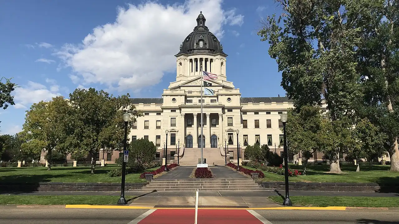
2. Which river-side city is the capital of South Dakota?
🤯 Mind-Blowing Fact • Grade 2
Even though Pierre is the state capital of South Dakota, locals pronounce its name 'Peer'—just like looking out over a boat pier!
✨ Word Sparks (Grade 2 Glossary)
Tap 🔊 to hear
granite
very hard speckled rock formed deep underground
spire
tall pointed tower of rock or stone
ranch
large farm where cattle or bison graze
🪝
How can one river split South Dakota into two completely different worlds?
1
East River and West River
Watch the wide Missouri River wind right down the middle of South Dakota! Locals call the eastern half 'East River,' where rich black soil grows corn, wheat, and sunflowers around Sioux Falls. Across the water in 'West River,' rolling lead to canyons and pine-covered mountains.
2
Black Hills and Mount Rushmore
Dark ponderosa pines make the Black Hills look almost black from far away. High on a cliff, workers carved sixty-foot faces of George Washington, Thomas Jefferson, Theodore Roosevelt, and Abraham Lincoln.
3
Striped Badlands and Deep Caves
Nearby, Badlands National Park glows with layered rock , while Wind Cave hides honeycomb crystals underground.
1. Which major river divides South Dakota into 'East River' and 'West River'?
2. Why do the Black Hills have that name?
🤯 Mind-Blowing Fact • Grade 3
Wind Cave in South Dakota actually 'breathes'—rushing air blows in or out of its natural entrance whenever outside air pressure changes!
✨ Word Sparks (Grade 3 Glossary)
Tap 🔊 to hear
proclamation
official public announcement made by a leader
erosion
wearing away of rock by wind and water
ally
trusted friend or partner who helps others
🪝
Why were North Dakota and South Dakota shuffled like playing cards when they became states on the very same day?
1
Twin States Signed Together
Picture President Benjamin Harrison sitting at his desk on November 2, 1889, holding two statehood from Dakota Territory. Because neither territory half wanted to be second, Harrison covered the titles and shuffled the papers before signing! Nobody knows which was signed first, so North Dakota became thirty-ninth alphabetically and South Dakota became the fortieth state.
2
Lakota, Dakota, and Nakota Heritage
The word 'Dakota' means 'friend' or '' in the Sioux languages spoken by the Lakota, Dakota, and Nakota nations. For centuries, these communities followed vast bison herds across the Great Plains and revered the Black Hills—called Paha Sapa—as sacred highland country.
3
Sculpting Granite History
Between 1927 and 1941, sculptor Gutzon Borglum and four hundred workers shaped Mount Rushmore's granite cliff to honor America's founding, growth, conservation, and unity.
4
Fossils and Breathing Caves
East of the hills, strips away half an inch of Badlands clay each year, uncovering fossils of ancient saber-toothed cats and three-toed horses.
1. Why did President Benjamin Harrison shuffle the statehood papers on November 2, 1889?
2. What does the name 'Dakota' mean in the languages of the Sioux nations?
🤯 Mind-Blowing Fact • Grade 4
One mile underground inside a former Black Hills gold mine in Lead, South Dakota, scientists run the Sanford Underground Research Facility to detect tiny cosmic particles called neutrinos!
✨ Word Sparks (Grade 4 Glossary)
Tap 🔊 to hear
butte
steep flat-topped hill standing alone on plains
homesteader
settler who farmed frontier land to own it
uplift
slow pushing upward of deep Earth rock layers
🪝
How did glaciers, ancient seas, and mountain uplift give South Dakota two distinct landscapes on opposite sides of one river?
1
A Tale of Glaciers and Uplift
Cross the Missouri River at central Pierre and the ground beneath your boots tells two totally different geologic stories. During the Ice Age, continental glaciers bulldozed eastern South Dakota ('East River') into level, mineral-rich farmland dotted with prairie kettle lakes around Sioux Falls, the state's largest city. West of the Missouri ('West River'), glaciers never reached; instead, wind-carved , shortgrass rangelands, and the ancient granite dome of the Black Hills rise steeply above the Great Plains.
2
Indigenous Stewardship and Lewis and Clark
Arikara farming villages along Missouri River terraces grew corn, beans, and squash, while Lakota, Dakota, and Nakota horse riders thrived across the plains. In 1804 and again in 1806, Meriwether Lewis and William Clark paddled up and down South Dakota's Missouri River corridor, exchanging peaceful council gifts and documenting pronghorn, prairie dogs, and bison.
3
Railroads, Statehood, and Carving Granite
Steamboats, , and railroads spurred Dakota Territory's rapid growth until South Dakota entered the Union as the fortieth state on November 2, 1889. Four decades later, sculptor Gutzon Borglum and his crew used carefully measured dynamite charges and jackhammers to carve Washington, Jefferson, Theodore Roosevelt, and Lincoln into Harney Peak granite.
4
Badlands Fossils and Modern Science
Today, Badlands National Park reveals thirty-million-year-old Oligocene mammal fossils, Custer State Park protects one of America's largest public bison herds, and physicists a mile underground in Lead study elusive subatomic particles.
1. Why is eastern South Dakota flat and full of lakes while western South Dakota has canyons and rugged hills?
2. What cutting-edge science happens a mile underground in Lead, South Dakota, today?
🤯 Mind-Blowing Fact • Grade 5
Wind Cave National Park in South Dakota became the world's very first cave national park in 1903 and contains about ninety-five percent of all known 'boxwork' calcite cave formations on Earth!
✨ Word Sparks (Grade 5 Glossary)
Tap 🔊 to hear
glacial till
rich crushed rock soil left by melting glaciers
paleontology
science that studies ancient life through fossils
boxwork
thin honeycomb mineral fins on cave ceilings
🪝
How do 1.8-billion-year-old granite peaks, thirty-million-year-old fossil beds, and deep underground physics labs coexist in one Great Plains state?
1
Physiographic Divide Along the Missouri Trench
Spanning 77,116 square miles across the northern Great Plains, South Dakota pivots along the Missouri River trench, where massive hydroelectric reservoirs such as Lake Oahe regulate water across the heartland. East of the river lies the glaciated Central Lowland—blanketed in fertile that supports soybeans, corn, wheat, and the thriving economic hub of Sioux Falls. West of the river stretches the unglaciated Great Plains, culminating in Black Elk Peak, which at 7,242 feet is the highest summit in the United States east of the Rocky Mountains.
2
Oceti Sakowin Homelands and River Trade
For centuries before territorial borders, the Oceti Sakowin—comprising the Lakota, Dakota, and Nakota peoples—alongside Arikara (Sahnish) earth-lodge agriculturists, turned the Missouri basin into an extensive trade network linking Rocky Mountain trails to Mississippi Valley markets. To the Lakota, the pine-draped uplift of Paha Sapa (the Black Hills) and Wind Cave—central to traditional emergence stories—held profound spiritual and ecological significance.
3
Territorial Division and 1889 Statehood
Organized as part of Dakota Territory in 1861, the region experienced booming railroad construction and the Great Dakota Boom of the 1870s and 1880s. Because southern and northern population centers grew hundreds of miles apart, Congress passed the Enabling Act of 1889 splitting the territory along the seventh standard parallel. On November 2, 1889, President Benjamin Harrison shuffled the two statehood proclamations unseen, admitting South Dakota as the fortieth state with centrally located Pierre as its capital.
4
Monumental Engineering and Conservation Pioneers
In 1903, President Theodore Roosevelt signed legislation making Wind Cave the first cave designated a national park anywhere in the world, famous for rare calcite '' fins. From 1927 to 1941, Gutzon Borglum and his son Lincoln Borglum directed four hundred workers who removed 450,000 tons of Precambrian granite without a single worker fatality to create Mount Rushmore National Memorial.
5
Oligocene Paleontology to Neutrino Science
East of the Black Hills, Badlands National Park exposes the world's richest Oligocene mammal fossil beds, while deep beneath Lead, the Sanford Underground Research Facility advances global astrophysics—proving South Dakota connects deep geologic time with tomorrow's discoveries.