1. What tree appears right in the center of South Carolina's blue flag?
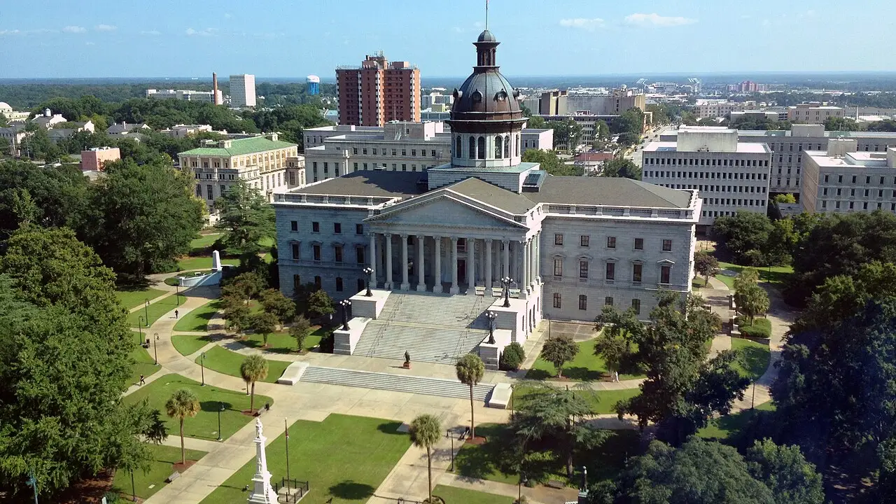
2. Which city in the middle of the state serves as South Carolina's capital?
🤯 Mind-Blowing Fact • Grade 2
In Congaree National Park, thousands of rare synchronous fireflies flash their lights at the exact same second on warm May evenings!
✨ Word Sparks (Grade 2 Glossary)
Tap 🔊 to hear
harbor
sheltered water where ships dock safely
spongy
soft and springy when pressed or hit
foothills
rolling hills at the base of mountains
🪝
Can spongy tree logs really bounce heavy cannonballs away from a fort?
1
The Fort Made of Spongy Logs
Boom! In June 1776, British warships fired cannonballs at a small island fort guarding Charleston . Patriots had stacked soft, sabal palmetto logs filled with sand. Instead of splintering, the springy logs bounced and trapped the cannonballs! That victory earned South Carolina its nickname, the Palmetto State.
2
Three Regions in One State
Travel across South Carolina and the land changes fast. Cool waterfalls tumble down the Blue Ridge Mountains, rolling hills surround the central capital of Columbia, and warm Sea Islands line the Atlantic coast.
3
Giant Trees of Congaree
Near Columbia, Congaree National Park protects towering champion trees where owls hoot and fireflies blink together on summer nights.
1. Why did palmetto logs work so well at the 1776 fort near Charleston Harbor?
2. What special natural place near Columbia protects giant old trees and flashing fireflies?
🤯 Mind-Blowing Fact • Grade 3
Columbia, South Carolina, was one of the very first planned cities in the United States, laid out with extra-wide avenues on a neat two-mile grid in 1786!
✨ Word Sparks (Grade 3 Glossary)
Tap 🔊 to hear
Piedmont
rolling hilly region between mountains and coast
barrier island
long sandy island protecting the mainland shore
skirmish
short fight between small groups of soldiers
🪝
Why did South Carolina move its capital inland from bustling Charleston to brand-new Columbia?
1
From Upcountry Peaks to Lowcountry Tides
Stand atop Sassafras Mountain in northwestern South Carolina and mist rises from Blue Ridge valleys. Journey southeast across the red-clay and sandy Midlands until salty creeks wind past in the Lowcountry. Few states pack mountains, river floodplains, and subtropical beaches into such a triangle-shaped map.
2
Turning Points of the Revolution
More than two hundred Revolutionary War battles and took place on South Carolina soil! After Colonel William Moultrie's palmetto-log fort defended Charleston Harbor in 1776, Patriot victories at Kings Mountain in 1780 and Cowpens in 1781 weakened British forces across the South.
3
Building a Central Capital
Coastal Charleston served as the early colonial capital, but Upcountry farmers had to travel days to reach lawmakers. In 1786, leaders planned a brand-new capital city—Columbia—right where the Broad and Saluda rivers meet to form the Congaree River.
4
Eighth State in the Union
On May 23, 1788, South Carolina ratified the U.S. Constitution to become America's eighth state.
1. Why did leaders choose Columbia's location in 1786 to be the new state capital?
2. Which two rivers join together at Columbia to form the Congaree River?
🤯 Mind-Blowing Fact • Grade 4
Gullah Geechee artisans in South Carolina's Lowcountry still coil fragrant sweetgrass, pine needles, and palmetto strips into museum-prized baskets using techniques passed down for over three hundred years!
✨ Word Sparks (Grade 4 Glossary)
Tap 🔊 to hear
Fall Line
boundary where upland rapids drop onto coastal plains
meander
wind back and forth in gentle curves
preservation
careful work protecting historic places or nature
🪝
How did geography divide South Carolina into Upcountry and Lowcountry—and how did rivers and rails connect them?
1
Five Distinct Landform Regions
Picture water racing off the Blue Ridge Escarpment in South Carolina's northwest corner, tumbling over rapids across the rolling Piedmont until it reaches the sandy near Columbia. Below those rapids, slow blackwater rivers such as the Edisto and Pee Dee across the Coastal Plain into the Lowcountry's Sea Islands, salt marshes, and loggerhead sea turtle nesting beaches.
2
Indigenous Roots and Colonial Crossroads
For millennia, the Cherokee in the western mountains, the Catawba along Piedmont rivers, and the Yamasee and Cusabo near the coast cultivated corn, crafted pottery, and navigated waterways. Founded in 1670, Charles Town—later Charleston—grew into one of colonial North America's busiest seaports. Along the Sea Islands, Gullah Geechee communities preserved vibrant West African traditions in sweetgrass basketry, music, storytelling, and coastal cuisine.
3
Revolutionary Crucible and Eighth State
During the American Revolution, South Carolina witnessed fierce fighting from Sullivan's Island in 1776 to Patriot triumphs at Kings Mountain and Cowpens that forced British General Cornwallis northward toward Virginia. Delegates including Charles Pinckney helped shape the U.S. Constitution in Philadelphia, and South Carolina ratified it on May 23, 1788.
4
Civil War History and Modern Innovation
In April 1861, the Civil War's opening shots sounded at Fort Sumter in Charleston Harbor, followed by Reconstruction reforms that established the state's first public school system. Today, South Carolina pairs historic and Congaree National Park conservation with bustling ports, automotive and aircraft manufacturing, and agriculture.
1. Which cultural community along South Carolina's Sea Islands is famous for coiled sweetgrass baskets and West African heritage?
2. How did Patriot victories at Kings Mountain and Cowpens in South Carolina affect the Revolutionary War?
🤯 Mind-Blowing Fact • Grade 5
In 1830, the Charleston & Hamburg Railroad ran the 'Best Friend of Charleston,' launching the first regularly scheduled American-built steam passenger train service in the nation!
✨ Word Sparks (Grade 5 Glossary)
Tap 🔊 to hear
confluence
exact place where two rivers flow together
bottomland
low fertile land along a river floodplain
stewardship
responsible care for natural resources and heritage
🪝
Why did more Revolutionary War engagements unfold in South Carolina than in almost any other colony?
1
From the Blue Ridge Escarpment to the Sea Islands
Stretching across 32,020 square miles from 3,553-foot Sassafras Mountain down to Atlantic barrier islands, South Carolina forms a natural cross-section of southeastern geology. Fast Piedmont tributaries—the Saluda, Broad, and Wateree—drop over granite ledges at the Fall Line before merging into the Santee and Congaree river basins. Downstream, Congaree National Park shelters the largest intact tract of old-growth hardwood forest in North America, where bald cypress and loblolly pines tower more than 160 feet high.
2
Indigenous Nations, Charleston Port, and Cultural Heritage
Cherokee towns in the Blue Ridge foothills and Catawba villages in the Piedmont traded deerskins, rivercane baskets, and pottery long before English colonists established Charles Town at the of the Ashley and Cooper rivers in 1670. As rice and indigo plantations expanded across tidal marshes through enslaved labor, African agricultural knowledge of floodgate irrigation proved vital, and Gullah Geechee descendants forged an enduring language, musical tradition, and sweetgrass craft across the Sea Islands.
3
Southern Strategy and Constitutional Statehood
After Colonel William Moultrie's palmetto-timbered fort on Sullivan's Island repelled a British fleet on June 28, 1776, fighting returned in 1780 when Britain captured Charleston to anchor its 'Southern Strategy.' Partisan leaders such as Francis Marion used swamp trails while Continental troops under Daniel Morgan executed a classic double-envelopment victory at Cowpens in January 1781. Following independence, lawmakers founded central Columbia in 1786 and ratified the U.S. Constitution on May 23, 1788, making South Carolina the eighth state.
4
Fort Sumter, Reconstruction, and Renewal
Decades of sectional tension over slavery and federal authority erupted on April 12, 1861, at Fort Sumter in Charleston Harbor, initiating the American Civil War. During Reconstruction, leaders including Robert Smalls championed statewide public education and expanded constitutional rights.
5
Global Manufacturing and Coastal Stewardship
Today, Upstate engineering corridors around Greenville-Spartanburg assemble automobiles and turbines, Charleston's deep-water port connects global shipping lanes, and Lowcountry reserves safeguard salt-marsh ecosystems.