1. Which ultra-deep blue lake in Oregon sits inside a collapsed volcano?
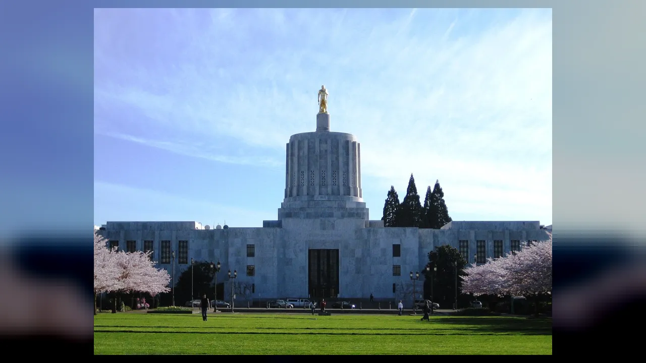
2. Which city is the state capital of Oregon?
🤯 Mind-Blowing Fact • Grade 2
Crater Lake in Oregon has no rivers flowing into or out of it—all its crystal-pure blue water comes straight from falling rain and winter snow!
✨ Word Sparks (Grade 2 Glossary)
Tap 🔊 to hear
puffin
Colorful seabird diving underwater to catch fish
valley
Low fertile land tucked between mountain ranges
lodge
Dome home built by beavers in water
🪝
Why does Oregon's state flag have two completely different pictures on the front and back?
1
Ocean Beaches for Everyone
Watch puffy tufted nest atop giant ocean boulders like Haystack Rock! All 363 miles of Oregon's Pacific beaches belong to the public, so anyone can explore tide pools and coastal lighthouses.
2
Lewis and Clark to the Oregon Trail
In 1805, Lewis and Clark reached the Pacific Ocean here and spent a rainy winter at Fort Clatsop. Decades later, pioneers rode covered wagons 2,170 miles along the Oregon Trail into the green Willamette around Salem, the state capital!
3
Valentine Statehood and a Two-Sided Flag
Admitted on February 14, 1859, as the thirty-third state, Oregon is the ONLY state whose flag has two different sides—a state shield on the front and a golden beaver on the back!
1. What makes Oregon's state flag unique among all fifty U.S. state flags?
2. Which winter fort did the Lewis and Clark Expedition build near the Oregon coast in 1805?
🤯 Mind-Blowing Fact • Grade 3
Hidden underground in Oregon's Malheur National Forest grows a single honey mushroom fungus network covering more than two thousand acres—one of the largest living organisms on Earth!
✨ Word Sparks (Grade 3 Glossary)
Tap 🔊 to hear
gorge
Extra-deep rocky canyon carved by a river
salmon
Leaping fish swimming from oceans up rivers
cascade
Steep series of waterfalls tumbling over rock
🪝
How can western Oregon be a lush mossy rainforest while eastern Oregon is a sunny high desert?
1
Mountains That Split the Weather
Look east from Portland or capital city Salem and admire snow-capped Mount Hood rising 11,249 feet in the volcanic Range! Moist Pacific clouds drop heavy rain on western Douglas-fir forests and the fertile Willamette Valley, leaving sunny sagebrush plains and painted hills across eastern Oregon.
2
Chinook Traders and Fort Clatsop
For ten thousand years, Chinook, Nez Perce, Klamath, Warm Springs, Siletz, and Coquille peoples harvested and traded along the mighty Columbia River. Reaching the Pacific in November 1805, Lewis and Clark—including Sacagawea and Clark's enslaved companion York—voted together on where to build winter quarters at Fort Clatsop!
3
End of the 2,170-Mile Trail
Starting in the 1840s, hundreds of thousands of pioneers walked beside ox-drawn wagons from Missouri to Oregon's Willamette Valley before Oregon became the thirty-third state on February 14, 1859.
4
Deepest Lake and Deepest Gorge
Collapsed volcano Mount Mazama formed 1,949-foot-deep Crater Lake, while the Snake River carved 7,993-foot-deep Hells Canyon—North America's deepest river —along the Idaho border!
1. Why is western Oregon rainy and green while eastern Oregon is much drier?
2. Which canyon on Oregon's eastern border with Idaho is deeper than even the Grand Canyon?
🤯 Mind-Blowing Fact • Grade 4
Oregon orchards grow ninety-nine percent of all the hazelnuts harvested in the entire United States!
✨ Word Sparks (Grade 4 Glossary)
Tap 🔊 to hear
initiative
Process letting voters propose laws directly
headland
High rocky point jutting out into ocean
basalt
Dark volcanic rock cooled from ancient lava
🪝
What historic vote at the Oregon coast in 1805 included a Shoshone woman and an enslaved African American man decades before national suffrage?
1
Sea Stacks, Volcanoes, and High Desert
Spanning 98,379 square miles along the Pacific Ring of Fire, Oregon packs astonishing geologic variety between the Columbia River on the north and California on the south. sea stacks frame 363 miles of coastal , while the Coast Range and Cascade volcanoes—Mount Hood, Mount Jefferson, and the Three Sisters—shelter the berry-, hazelnut-, and nursery-rich Willamette Valley. Roughly 7,700 years ago, volcano Mount Mazama collapsed into a five-mile-wide caldera that filled with snowmelt to create 1,949-foot-deep Crater Lake!
2
Celilo Salmon Hub and the Fort Clatsop Vote
Nine federally recognized Tribal Nations steward ancestral homelands across Oregon today. For millennia at Celilo Falls on the Columbia River, Indigenous fishers dip-netted salmon at North America's oldest continuously operating trading crossroads. On November 24, 1805, deciding where to camp for the winter near the mouth of the Columbia, Captains Lewis and Clark recorded every expedition member's vote—including Shoshone interpreter Sacagawea and enslaved explorer York—resulting in Fort Clatsop!
3
Oregon Trail and Valentine Statehood
Following the 1846 Oregon Treaty with Great Britain establishing the 49th parallel border, wagon trains poured down the Columbia Gorge and Barlow Road to Oregon City and Salem. Admitted as a free state on February 14, 1859, Oregon pioneered direct citizen democracy tools—the ballot and referendum—in 1902.
4
People's Coast and Silicon Forest
Oregon's landmark 1967 Beach Bill permanently guaranteed public access to every ocean beach from low tide to coastal vegetation, matching modern leadership in clean hydropower, forestry, athletic footwear design, and 'Silicon Forest' microchips near Portland.
1. Why is the November 24, 1805 vote by the Lewis and Clark Expedition near Oregon's coast remembered in civic history?
2. What landmark 1967 Oregon law kept all 363 miles of Pacific beaches open to everyone?
🤯 Mind-Blowing Fact • Grade 5
Portland, Oregon native Linus Pauling is the ONLY person in world history to win two unshared Nobel Prizes—the 1954 Nobel Prize in Chemistry and the 1962 Nobel Peace Prize!
✨ Word Sparks (Grade 5 Glossary)
Tap 🔊 to hear
subduction
One Earth crust plate sliding beneath another
referendum
Direct citizen vote approving or rejecting laws
estuary
Tidal river mouth meeting salty ocean currents
🪝
How did subduction-zone volcanoes, Columbia River salmon diplomacy, overland wagon migration, and progressive civic laws define Oregon's character?
1
Cascadia Subduction, Mount Mazama, and Hells Canyon
Offshore along the Pacific Northwest, the Juan de Fuca tectonic plate subducts beneath North America, uplifting Oregon's 98,379 square miles into dramatic west-to-east belts. Wave-sculpted basalt sea stacks guard a 363-mile shoreline ahead of temperate Sitka-spruce rainforests in the Coast Range and Ice Age Missoula Flood silts carpeting the lush Willamette Valley around Salem and Portland. Eastward rises the High Cascade volcanic arc—crowned by 11,249-foot Mount Hood and 1,949-foot-deep Crater Lake, formed around 5700 BCE when Mount Mazama's cataclysmic eruption collapsed into a caldera—before dropping into arid Columbia Plateau basalts, John Day fossil beds, and 7,993-foot-deep Hells Canyon along the Snake River.
2
Celilo Falls Metropolis and the 1805 Station Camp Poll
For over ten millennia, Chinookan, Sahaptin, Nez Perce (Nimiipuu), Klamath, Modoc, Northern Paiute, Siletz, Grand Ronde, Coquille, Burns Paiute, Cow Creek Umpqua, and Coos-Lower Umpqua-Siuslaw peoples sustained thriving fisheries and basketry traditions, converging at Celilo Falls ('Wyam') along the Columbia River—North America's longest-running Indigenous trade emporium prior to 1957 dam inundation. Reaching the Pacific in November 1805, Meriwether Lewis and William Clark polled the entire Corps of Discovery—expressly recording the votes of Lemhi Shoshone interpreter Sacagawea and enslaved African American scout York—before constructing Fort Clatsop near present-day Astoria.
3
Maritime Fur Trade, Oregon Trail, and 1859 Statehood
After Captain Robert Gray sailed into the Columbia River in 1792 and John Jacob Astor founded Astoria in 1811, joint U.S.-British occupation yielded to the 1846 Oregon Treaty along the 49th parallel. Simultaneously, over 300,000 emigrants trekked the 2,170-mile Oregon Trail across South Pass and down the Columbia Gorge or Mount Hood's Barlow Road into the Willamette Valley, propelling Oregon into the Union as the thirty-third state on February 14, 1859.
4
The 'Oregon System' of Direct Democracy and Public Shores
Early twentieth-century reformers led by William S. U'Ren crafted the 'Oregon System'—adopting the citizen ballot initiative and (1902), direct primary, and popular election of U.S. senators ahead of the Seventeenth Amendment. In conservation, Governor Oswald West (1913) and Governor Tom McCall's 1967 Oregon Beach Bill enshrined universal public ownership of all 363 miles of oceanfront, followed by America's first bottle-recycling law in 1971.
5
Linus Pauling, Hydroelectricity, and the Silicon Forest
Birthplace of Portland chemist Linus Pauling—the only individual ever awarded two unshared Nobel Prizes (Chemistry and Peace)—modern Oregon pairs Bonneville hydroelectric power and sustainable forestry with high-tech semiconductor manufacturing in the 'Silicon Forest' and world-leading athletic engineering.