1. Which great American river begins as a small stream at Lake Itasca in Minnesota?
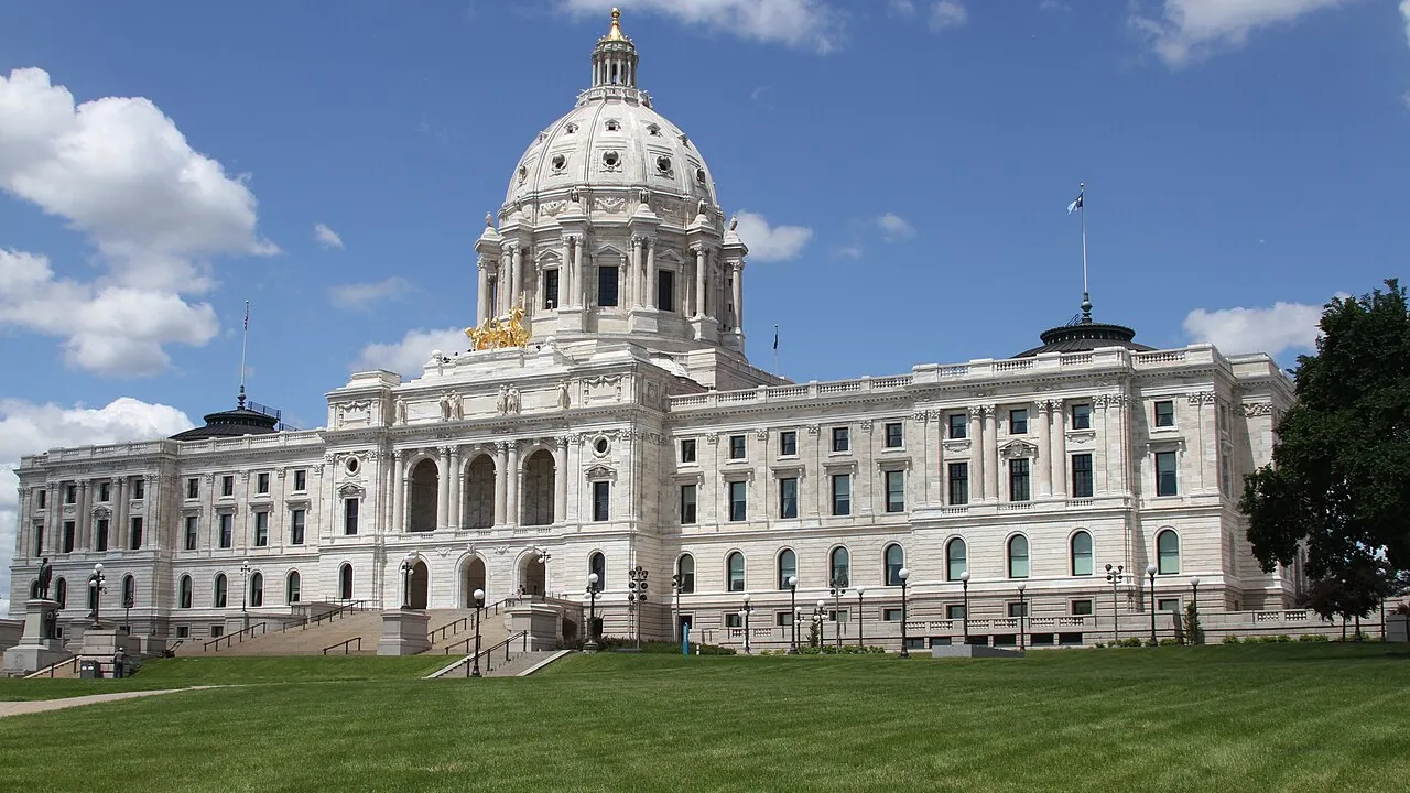
2. Which city is the state capital of Minnesota?
🤯 Mind-Blowing Fact • Grade 2
Water-skiing, rollerblades, and pop-up bread toasters were all invented by clever thinkers in Minnesota!
✨ Word Sparks (Grade 2 Glossary)
Tap 🔊 to hear
headwaters
Exact starting place where a river begins
prairie
Wide, flat grassland with very few trees
mill
Building with machines that grind grain into flour
🪝
What Dakota words gave Minnesota its poetic sky-colored name?
1
Waters That Reflect the Sky
Listen as a loon's echoing song drifts across glassy morning water! Long ago, Dakota people named this homeland 'Mni Sota,' meaning sky-tinted water that reflects the clouds. Today, 11,842 lakes sparkle across and northern pine forests.
2
Where a Giant River Begins
Up north at Lake Itasca, clear water spills over rocks to start the 2,340-mile Mississippi River! Downstream, Saint Paul serves as Minnesota's state capital right beside Minneapolis, where rushing river falls once powered giant flour .
3
North Star State
Minnesota became the thirty-second U.S. state on May 11, 1858. Known as the North Star State, it touches Lake Superior's rocky shore, grows golden corn and wild rice, and welcomes winter snow with ice skating and sledding!
2. What two cities sit side by side along the Mississippi River as the 'Twin Cities'?
🤯 Mind-Blowing Fact • Grade 3
Because of a little peninsula jutting into Lake of the Woods called the Northwest Angle, Minnesota reaches farther north than Maine or any other state in the lower forty-eight!
✨ Word Sparks (Grade 3 Glossary)
Tap 🔊 to hear
voyageur
Early canoe paddler who transported traded furs
manoomin
Nutritious wild rice growing in shallow lakes
steamboat
River vessel pushed by steam-powered paddle wheels
🪝
How did glaciers, waterfalls, and red iron rocks shape the North Star State?
1
Carved by Ancient Ice
Dip a wooden paddle into the Boundary Waters wilderness, where clear lakes connect like liquid highways through spruce and birch forests! Thousands of years ago, giant glaciers scooped hollows across Minnesota that melted into 11,842 lakes. Along the northeastern edge, waves crash against steep cliffs on Lake Superior.
2
Dakota and Ojibwe Homelands
Dakota and Ojibwe (Anishinaabe) nations have stewarded these woodlands, prairies, and wild-rice beds—called ''—for generations. French-Canadian later paddled fur-trading canoes through northern waterways before the United States built Fort Snelling where the Minnesota and Mississippi Rivers meet.
3
Waterfalls, Flour, and Iron Ore
Admitted as the thirty-second state on May 11, 1858, Minnesota boomed around St. Anthony Falls in Minneapolis, which powered the world's largest wheat-flour mills, while neighboring Saint Paul grew as a port and state capital. Farther north, Mesabi Range miners uncovered rich red iron ore needed to forge American steel.
4
World-Famous Healing and Northern Pride
In Rochester, doctors founded the Mayo Clinic, where medical teams collaborate to help patients from around the globe.
1. How were thousands of Minnesota's lakes originally formed?
2. What natural resource from Minnesota's Mesabi Range helped build America's skyscrapers, bridges, and railroads?
🤯 Mind-Blowing Fact • Grade 4
In 1922, eighteen-year-old Ralph Samuelson strapped curved pine boards to his feet on Lake Pepin in Minnesota and invented the sport of water-skiing!
✨ Word Sparks (Grade 4 Glossary)
Tap 🔊 to hear
divide
High ridge splitting rivers toward different oceans
boreal
Northern forest zone of pines and spruces
regiment
Organized military unit of hundreds of soldiers
🪝
Why do waters falling in northern Minnesota flow toward three completely different ends of North America?
1
A Triple Continental Divide
Stand near Hibbing in northern Minnesota during a summer rainstorm, and three raindrops landing side by side can embark on three astonishingly different journeys! One drop flows east through Lake Superior to the Atlantic Ocean, a second travels north via the Red River toward Hudson Bay, and a third winds 2,340 miles south down the Mississippi River from Lake Itasca to the Gulf of Mexico. Across 86,936 square miles, Minnesota blends tallgrass prairies, hardwood valleys, and pine wilderness.
2
Indigenous Heritage and Territorial Growth
Named from the Dakota phrase 'Mni Sota Makoce'—'land where the waters reflect the sky'—this crossroads sustained Dakota bison hunters on western plains and Ojibwe wild-rice harvesters across northern lakes. Organized from parts of the old Northwest Territory and the Louisiana Purchase, Minnesota entered the Union on May 11, 1858, adopting the French motto 'L'Étoile du Nord' ('The Star of the North'). During the Civil War just three years later, the First Minnesota Volunteer Infantry became one of the very first offered to defend the Union and stood heroically at Gettysburg.
3
Flour Capital and the Iron Range
Harnessing the fifty-foot drop of St. Anthony Falls, Minneapolis earned the title 'Flour Milling Capital of the World,' shipping grain across rail networks centered on capital city Saint Paul. Meanwhile, open-pit mines along the Mesabi, Vermilion, and Cuyuna Ranges supplied over two-thirds of America's iron ore during the twentieth century, loaded onto ore freighters in Duluth harbor.
4
Medical Breakthroughs and Protected Wilderness
Following a destructive 1883 tornado in Rochester, Dr. William Worrall Mayo, his sons, and the Sisters of Saint Francis built the hospital that evolved into the world-renowned Mayo Clinic, pioneering wearable pacemakers and team-based medicine alongside Minnesota's treasured Voyageurs National Park.
1. Into which three major bodies of water do Minnesota's three watersheds eventually empty?
2. Which Minnesota city became famous worldwide when the Mayo family and Sisters of Saint Francis founded a collaborative medical clinic there?
🤯 Mind-Blowing Fact • Grade 5
Ships docked at Duluth, Minnesota on Lake Superior sit 2,342 miles inland from the Atlantic Ocean—making Duluth the farthest-inland freshwater seaport accessible to ocean freighters on Earth!
✨ Word Sparks (Grade 5 Glossary)
Tap 🔊 to hear
confluence
Place where two flowing rivers join together
biome
Large natural region sharing climate and wildlife
taconite
Hard iron-bearing rock processed into steel pellets
🪝
How did a glaciated watershed where three continental basins meet become a cornerstone of American grain trade, steel production, and biomedical science?
1
Glacial Geomorphology and the Triple Watershed
Few places on Earth display the sculpting power of Pleistocene glaciation more vividly than Minnesota. Spanning 86,936 square miles—and reaching 49 degrees 23 minutes north at the Northwest Angle, the northernmost point in the contiguous forty-eight states—Minnesota unites three major North American : western tallgrass prairie, central deciduous 'Big Woods,' and northeastern Laurentian boreal forest rising to 2,301 feet at Eagle Mountain. Near Hibbing, the Laurentian and St. Lawrence divides intersect, sending surface waters toward Hudson Bay via the Red River of the North, eastward through Lake Superior and the Great Lakes, and southward from Lake Itasca (elevation 1,475 feet) as the headwaters of the 2,340-mile Mississippi River.
2
Mni Sota Makoce, Manoomin, and Early Exploration
For millennia, Dakota Oyate communities stewarded river valleys sacred to Bdote—the of the Minnesota and Mississippi Rivers—while Anishinaabe (Ojibwe) bands harvested 'manoomin' (wild rice) across shallow glacial lakes and carved sacred red pipestone ('catlinite') in the southwest. European fur traders, explorers like Henry Rowe Schoolcraft—who documented Lake Itasca as the Mississippi's true source in 1832 with Ojibwe guide Ozawindib—and Scandinavian, German, and Yankee settlers converged before Congress admitted Minnesota as the thirty-second state on May 11, 1858.
3
Union Valor and Twin Cities Industry
In April 1861, Governor Alexander Ramsey happened to be in Washington, D.C., making Minnesota the first state to volunteer troops for President Abraham Lincoln; on July 2, 1863, the First Minnesota Infantry's daring charge plugged a critical gap in the Union line at Gettysburg. Postwar engineers harnessed St. Anthony Falls in Minneapolis—the only natural major waterfall on the upper Mississippi—to drive roller-milling turbines, while neighboring capital Saint Paul anchored transcontinental railroads reaching the Pacific Northwest.
4
Iron Ranges and the Duluth Maritime Gateway
Beginning in the 1880s and 1890s, massive hematite and deposits across the Vermilion and Mesabi Iron Ranges fueled America's steel transformation. Rail cars carried millions of tons of rust-red ore down to Lake Superior docks at Duluth—the world's farthest-inland ocean-going port, linked 2,342 miles to the Atlantic via the St. Lawrence Seaway.
5
Biomedical Alley and Wilderness Conservation
Today, Minnesota pairs agricultural leadership in sugarbeets, corn, and soybeans with 'Medical Alley' breakthroughs—from Earl Bakken's wearable battery-powered cardiac pacemaker in Minneapolis to Rochester's Mayo Clinic—while safeguarding over one million roadless canoe-country acres in the Boundary Waters and Voyageurs National Park.