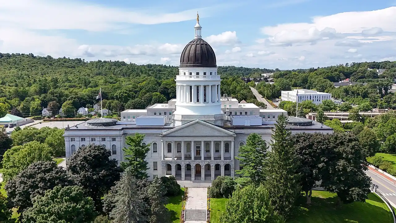
1. How many other U.S. states touch the border of Maine?
2. What is the capital city of the State of Maine?
🤯 Mind-Blowing Fact • Grade 2
Maine's official state flower isn't a petal blossom at all—it is the white pine cone and tassel!
✨ Word Sparks (Grade 2 Glossary)
Tap 🔊 to hear
harbor
Calm rocky cove sheltering colorful lobster boats
evergreen
Tree keeping green needles all winter long
sunrise
Morning moment when the sun first appears
🪝
How did a chilly fifteen-year-old skater in Maine invent cozy earmuffs?
1
Warm Ears in Winter!
Lace up ice skates on a snowy pond in Farmington, Maine! In 1873, fifteen-year-old Chester Greenwood's ears got super cold while skating, so he bent a wire loop and asked his grandmother to sew soft fur pads onto the ends—inventing cozy earmuffs!
2
Part of Massachusetts Until 1820
Did you know Maine used to belong to Massachusetts? On March 15, 1820, Maine separated peacefully and joined the Union as our twenty-third state, choosing Augusta as its capital.
3
First Sunrise at Acadia
Because Maine sticks farthest east in the United States, hikers atop Cadillac Mountain in Acadia National Park often greet America's very first golden !
1. What winter gear did fifteen-year-old Chester Greenwood invent in Farmington, Maine, in 1873?
2. Which state did Maine belong to before becoming our twenty-third state in 1820?
🤯 Mind-Blowing Fact • Grade 3
Maine's official state berry is the wild lowbush blueberry—grown on ancient glacial soils that yield nearly all of America's wild blueberry harvest!
✨ Word Sparks (Grade 3 Glossary)
Tap 🔊 to hear
inlet
Narrow arm of sea reaching into land
sustainable
Harvesting carefully so wildlife thrives for tomorrow
granite
Pinkish-gray hard rock forming Maine's cliffs
🪝
How does a coast only 228 miles wide stretch to over 3,400 miles of shoreline?
1
Glaciers Carved a Zigzag Coast
Fly in a small plane above Maine's coast and count thousands of rocky coves, narrow peninsulas, and spruce-covered islands! If you drew a straight line along the ocean, Maine measures 228 miles, yet tracing every jagged bay and stretches the tidal shoreline to 3,478 miles—longer than California's!
2
George Washington's Lighthouse and Lobsters
President George Washington ordered the construction of Portland Head Light, first lit with whale-oil lamps in January 1791. Offshore in the chilly, nutrient-rich Gulf of Maine, fishers harvest millions of pounds of prized American lobsters and sustainably release oversized breeding lobsters back into the sea.
3
Northern Finish Line on Mount Katahdin
Deep in Maine's northern woods—where forests cover nearly eighty-nine percent of the state, highest in America—rises 5,269-foot Mount Katahdin, marking the northern finish line of the 2,190-mile Appalachian Trail!
4
Missouri Compromise Statehood
Under the Compromise of 1820, Maine entered the Union as a free state on March 15, 1820, keeping the U.S. Senate balanced.
1. Why is Maine's tidal shoreline more than 3,400 miles long even though a straight line along its coast is only 228 miles?
2. Which mountain in Maine marks the northern end of the 2,190-mile Appalachian Trail?
🤯 Mind-Blowing Fact • Grade 4
Maine is so large compared to its neighbors that you could fit all five other New England states—New Hampshire, Vermont, Massachusetts, Rhode Island, and Connecticut—almost completely inside Maine!
✨ Word Sparks (Grade 4 Glossary)
Tap 🔊 to hear
confederacy
Alliance of nations working peacefully together
bedrock
Solid unbroken rock underneath soil or water
shipyard
Waterfront workshop where ocean vessels are built
🪝
Why do Atlantic puffins, extreme twenty-foot ocean tides, and Wabanaki 'People of the Dawnland' call Maine home?
1
People of the Dawnland
Long before European ships sighted West Quoddy Head—the easternmost point of land in the contiguous United States—the Wabanaki (Maliseet, Mi'kmaq, Passamaquoddy, and Penobscot nations) named their homeland Dawnland because morning light touches these shores first! Skilled Wabanaki craftspeople stitched lightweight white-birchbark canoes sealed with spruce resin to navigate swift rivers and coastal islands.
2
Drowned River Valleys and Giant Tides
During the last Ice Age, mile-thick ice pressed Maine's granite downward while carving deep U-shaped valleys—including Somes Sound on Mount Desert Island, the East Coast's only fjard! When melting glaciers raised sea levels, ocean water flooded the ridges into more than 4,600 coastal islands, where nesting Atlantic puffins dive for fish and Passamaquoddy Bay funnels roaring twenty-foot tides.
3
From Wooden Ship Masts to 1820 Statehood
Straight 150-foot eastern white pines once supplied masts for giant sailing vessels, inspiring Bath's historic along the Kennebec River. Admitted on March 15, 1820, under the Missouri Compromise as the twenty-third state, Maine encompasses nearly half of New England's entire land area!
4
Conservation Pioneer at Acadia
Established through citizen land donations starting in 1916, Acadia National Park became the first national park east of the Mississippi River.
1. Why did the Indigenous Wabanaki nations call their Maine homeland 'Dawnland'?
2. How was Acadia National Park originally created starting in 1916?
🤯 Mind-Blowing Fact • Grade 5
To protect future baby lobsters, Maine fishers cut a harmless tiny 'V-notch' in the tail flipper of egg-bearing mother lobsters so every boat knows to release them safely back into the ocean!
✨ Word Sparks (Grade 5 Glossary)
Tap 🔊 to hear
carapace
Hard protective upper shell of a crustacean
parity
Equal balance between two sides in voting
whirlpool
Swirling circular current caused by strong tides
🪝
What links Silurian-Devonian granite plutons, Gulf of Maine marine conservation, the 1820 Missouri Compromise, and wooden-to-destroyer shipbuilding in the Pine Tree State?
1
Glaciated Plutons and Drowned Coast Geomorphology
Covering 35,385 square miles—nearly equal to the other five New England states combined—Maine owes its rugged 'drowned coastline' to Paleozoic granite plutons sculpted by the Laurentide Ice Sheet. As Pleistocene ice over a mile thick scoured southeastward across Mount Katahdin and Cadillac Mountain, it plucked asymmetrical roche moutonnée granite domes and carved deep coastal troughs. Rising post-glacial seas submerged highland ridges into more than 4,600 islands and 3,478 miles of tidal shoreline, while funnel-shaped bays near the Bay of Fundy generate tidal ranges exceeding twenty feet and spin the Old Sow off Eastport!
2
Wabanaki Stewardship, 1820 Statehood, and the Aroostook Border
For over ten thousand years, Wabanaki nations—Penobscot, Passamaquoddy, Mi'kmaq, and Houlton Band of Maliseet—stewarded riverine salmon runs and coastal clam flats. Governed by Massachusetts from the 1650s onward despite being physically separated by New Hampshire, Maine achieved statehood on March 15, 1820, as the twenty-third state under Henry Clay's Missouri Compromise, maintaining Senate between free and slave states. Later, the peaceful 1842 Webster-Ashburton Treaty resolved the disputed northern Aroostook timber border with British New Brunswick.
3
Commons Conservation in the Gulf of Maine
Cold Labrador Current waters mixing over underwater banks nourish one of Earth's most productive marine ecosystems. For over a century, Maine lobstermen have practiced science-backed co-management—measuring with brass gauges to throw back both juvenile lobsters and giant egg-bearing females marked with a tiny 'V-notch' in their tail flipper, sustaining record catches for generations! Meanwhile, ornithologist Stephen Kress pioneered 'Project Puffin' on Eastern Egg Rock in 1973, using wooden decoys and mirror boxes to restore nesting Atlantic puffins.
4
Civic Voices and Maritime Engineering
From Joshua Lawrence Chamberlain—the Bowdoin College professor whose defense at Gettysburg helped preserve the Union—and trailblazing U.S. Senator Margaret Chase Smith to Bath Iron Works building modern naval vessels along the Kennebec River since 1884, Maine pairs civic duty with maritime skill.
5
Forest Bioeconomy and Offshore Wind
With roughly eighty-nine percent forest cover—the highest percentage in the nation—Maine leads sustainable forestry, Aroostook potato and wild lowbush blueberry harvests, and floating offshore wind engineering.