🇺🇸 U.S. HISTORY
🏛️ Ancestral Puebloan Ceremonial & Astronomical Center • UNESCO World Heritage Site
VA History & Social Science SOL K.1, 1.2, 2.4, VS.1–VS.10, USI & USII
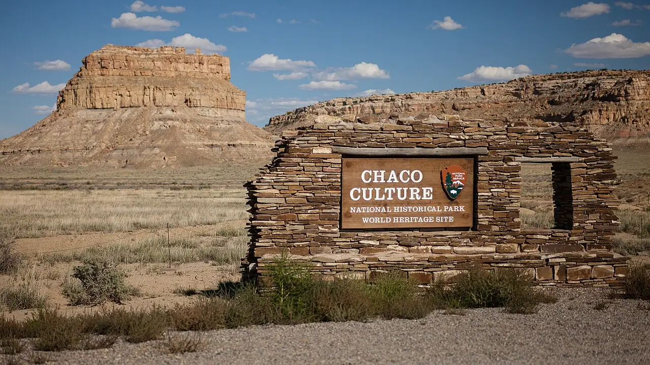
Chaco Canyon Ancestral Puebloans
Desert Great Houses Aligned With Stars
Grade 1 • Early Reader • 74 words
⏳ Era / StatehoodFlourished c. 850–1150 CE • Protected National Monument 1907
🗺️ Region / CapitalNorthwestern New Mexico (San Juan Basin • 6,200 ft)
📜 Key MilestonePueblo Bonito (600+ Rooms), Sun Dagger & 400 Miles of Straight Roads
⚡ Historical SparkAligned monumental stone Great Houses with solar and lunar cycles across a desert canyon
🤯 Mind-Blowing Fact • Grade 1
Until tall apartments were built in New York City in the 1880s, Pueblo Bonito in Chaco Canyon had been one of the tallest multi-story buildings in the United States for centuries!
✨ Word Sparks (Grade 1 Glossary)
Tap 🔊 to hear
canyon
A deep valley with steep rock walls
desert
Very dry land with little rainfall
align
To put things in a straight line
🪝
How did ancient builders make a giant stone castle in the desert line up with the sun?
1
Giant Stone Houses
Squint into the bright New Mexico sun! One thousand years ago, Ancestral Puebloan builders stacked neat flat stones to make huge Great Houses in Chaco .
2
Six Hundred Rooms!
The biggest building, Pueblo Bonito, was four stories tall with over six hundred rooms! Workers carried heavy pine logs fifty miles by hand for roofs.
3
Watching the Sky
Builders lined up stone walls and doorways with the rising sun and moon. Today, Chaco is a famous starry sky park!
2. About how many rooms did the giant Great House called Pueblo Bonito have?
🤯 Mind-Blowing Fact • Grade 2
Chacoan engineers carved straight thirty-foot-wide roads right across desert mesas—and instead of curving around steep cliffs, they chipped rock stairways straight up the cliff face!
✨ Word Sparks (Grade 2 Glossary)
Tap 🔊 to hear
butte
Steep, flat-topped hill standing all alone
petroglyph
Design carved or pecked into solid rock
beam
Long, strong log holding up a roof
🪝
Why did Ancestral Puebloans carry 200,000 giant tree trunks fifty miles across a dry desert on foot?
1
Great Houses in a Dry Canyon
Imagine walking across a sunny desert canyon in New Mexico a thousand years ago and spotting twelve massive stone buildings! Between 850 and 1150 CE, Ancestral Puebloans built Chaco Canyon into a grand gathering center. Pueblo Bonito alone curved like a giant letter D with over six hundred rooms and thirty-five round kivas.
2
Carrying Logs and Carving Roads
Few big trees grew in the dry canyon, so teams carried more than 200,000 pine logs on foot from mountains fifty miles away without horses or wheels! They also built wide, arrow-straight roads stretching hundreds of miles.
3
Daggers of Sunlight
Atop tall Fajada , leaning stone slabs cast a glowing blade of sunlight onto a spiral rock carving each first day of summer.
1. How did builders bring 200,000 roof logs from mountains fifty miles away to Chaco Canyon?
2. What happened on Fajada Butte on the first day of summer?
🤯 Mind-Blowing Fact • Grade 3
Scientists testing ancient painted pottery jars from Pueblo Bonito discovered chemical traces of liquid chocolate traded more than 1,200 miles northward from tropical Mexico!
✨ Word Sparks (Grade 3 Glossary)
Tap 🔊 to hear
arid
Extremely dry with very little rain
veneer
Neat outer layer of fitted stone blocks
cacao
Tropical bean used to make chocolate
🪝
How did Chaco Canyon connect distant towns, track the sun and moon, and trade for chocolate over a thousand miles away?
1
Heart of the San Juan Basin
Step into northwestern New Mexico's San Juan Basin, where scorching summers and freezing winters make survival tough. Yet between 850 and 1150 CE, Ancestral Puebloans engineered runoff dams and transformed Chaco Canyon into the ceremonial, architectural, and astronomical capital of the Four Corners world.
2
Core-and-Veneer Stonework
Chacoan masons invented 'core-and-' walls: a thick rubble core faced on both sides with thousands of thin, tightly fitted sandstone tablets strong enough to hold four or five stories. Pueblo Bonito, meaning 'Beautiful Town,' covered over three acres with more than six hundred rooms and giant circular Great Kivas up to sixty feet wide.
3
Sky Watchers and Straight Roads
Builders aligned Pueblo Bonito's straight southern wall precisely east-to-west to mark the equinoxes, while atop Fajada Butte, the Sun Dagger split a carved rock spiral on the summer solstice. Four hundred miles of thirty-foot-wide engineered roads radiated outward to more than 150 outlying communities.
4
Chocolate and Scarlet Macaws
Chemical tests inside tall painted cylinder jars at Pueblo Bonito revealed traces of —chocolate—traded alongside turquoise and colorful scarlet macaw feathers from Mexico over 1,200 miles south!
1. Why did Chacoan masons use 'core-and-veneer' stone walls?
2. What surprising tropical items reached Chaco Canyon along 1,200-mile trade networks from Mexico?
🤯 Mind-Blowing Fact • Grade 4
Chacoan astronomers tracked not only the yearly sun cycles, but also a rare 18.6-year cycle of the rising and setting moon!
✨ Word Sparks (Grade 4 Glossary)
Tap 🔊 to hear
facade
The main front wall of a building
outlier
Distant community connected to a central hub
standstill
Extreme northern or southern moonrise cycle point
🪝
How did Ancestral Puebloan astronomers turn entire multi-story buildings and desert roads into a cosmic map of sky and seasons?
1
Architecture on a Grand Scale
Stand along the canyon floor of Chaco Culture National Historical Park in New Mexico and gaze up at twelve monumental Great Houses built between 850 and 1150 CE. Unlike ordinary farm villages, Great Houses such as Pueblo Bonito, Chetro Ketl, and Casa Rinconada were planned from the ground up as vast civic and ceremonial complexes. Constructing them required quarrying millions of sandstone blocks and carrying more than 200,000 spruce, fir, and ponderosa pine timbers up to fifty miles from the Chuska and San Mateo mountains.
2
Buildings Aligned With Sun and Moon
In 1977, artist Anna Sofaer documented the 'Sun Dagger' high on 400-foot Fajada Butte, where three sandstone slabs channeled shafts of light across two carved spirals to mark summer solstice, winter solstice, equinoxes, and even the 18.6-year lunar cycle! Down below, Pueblo Bonito's central dividing wall runs true north-south while its front wall runs true east-west, so on the spring and autumn equinoxes the sun rises and sets directly along the building's .
3
The Great North Road and Signal Fires
Over four hundred miles of engineered Chacoan roads—often thirty feet wide and cleared to bedrock—linked more than 150 communities across the Four Corners. Line-of-sight stone shrines perched on high mesas allowed messengers to flash mirror or fire signals across dozens of miles in minutes.
4
Living Heritage and Starry Skies
After severe twelfth-century droughts beginning around 1130 CE, Chaco's builders migrated to Mesa Verde, Zuni, Hopi, and Rio Grande pueblos. Protected by President Theodore Roosevelt in 1907 and named a UNESCO World Heritage Site in 1987, Chaco is also a certified International Dark Sky Park.
1. How is Pueblo Bonito's straight southern wall aligned with the sky?
2. How did Chacoan communities communicate quickly across dozens of miles of open desert?
🤯 Mind-Blowing Fact • Grade 5
Scientists used strontium-isotope chemistry—matching chemical fingerprints in ancient wood beams to mountain bedrock—to prove Chaco's builders carried heavy spruce and fir trees from mountain peaks fifty miles away!
✨ Word Sparks (Grade 5 Glossary)
Tap 🔊 to hear
subterranean
Built or located beneath the ground
azimuth
Compass direction toward a horizon sky point
theobromine
Natural chemical compound unique to cacao chocolate
🪝
What does Chaco Canyon reveal about regional governance, long-distance Mesoamerican trade, and precision archaeoastronomy in ancient North America?
1
Monumentality in an Arid Basin
At 6,200 feet elevation in northwestern New Mexico's San Juan Basin, Chaco Canyon receives barely nine inches of precipitation a year. Yet between 850 and 1150 CE, Ancestral Puebloan planners harnessed flash-flood runoff from side-canyon slickrock through diversion dams, canals, and gridded waffle gardens to sustain North America's most ambitious architectural phenomenon: twelve canyon-floor and mesa-top Great Houses linking more than 150 outlying communities across 30,000 square miles of the Four Corners.
2
Pueblo Bonito and Timber Logistics
Constructed in planned stages over three centuries, D-shaped Pueblo Bonito spanned more than three acres, rose four to five stories along its curved northern arc, and enclosed over 600 rooms, 32 small kivas, and three Great Kivas up to sixty feet in diameter. Its load-bearing core-and-veneer walls—up to three feet thick at ground level—supported roofs framed with roughly 240,000 coniferous beams across the canyon. Strontium-isotope analysis of wood samples proves workers carried ponderosa pine, spruce, and fir logs fifty miles overland from the Chuska and Zuni mountains without pack animals or wheeled carts.
3
Solar and Lunar Cosmography
Archaeoastronomical surveys initiated by Anna Sofaer's Solstice Project demonstrated that Chacoan architecture embodied sky cycles at multiple scales. Atop 400-foot Fajada Butte, three leaning sandstone slabs projected daggers of sunlight onto two pecked spirals to record solstices, equinoxes, and the major and minor 18.6-year lunar standstills. Across the canyon floor, Great Houses were oriented to cardinal directions—such as Pueblo Bonito's east-west southern wall and Casa Rinconada's symmetrical north-south axis—or to solar and lunar , while straight thirty-foot-wide roads like the thirty-five-mile Great North Road expressed sacred directional order.
4
Turquoise Workshops and Mesoamerican Exchange
Chaco functioned as a preeminent turquoise-processing center, fashioning tens of thousands of beads and inlays—over 50,000 turquoise pieces were recovered from a single room at Pueblo Bonito! In return, long-distance trade networks extending 1,200 miles south into Mesoamerica brought cast copper bells from western Mexico, scarlet macaws (Ara macao) prized for brilliant solar-red plumage, and cacao beans whose residue was identified in 2009 by chemist Patricia Crown inside Chacoan ceramic cylinder vessels.
5
Climatic Transition and Ancestral Continuity
A severe fifty-year drought beginning around 1130 CE prompted Chacoans to shift regional centers northward toward Aztec Ruins and Mesa Verde and ultimately to Hopi, Zuni, Acoma, Laguna, and Rio Grande pueblos, whose oral histories preserve living memories of Yupköyvi and White House. Proclaimed a National Monument in 1907 under the Antiquities Act and inscribed by UNESCO in 1987, Chaco Canyon honors centuries of Indigenous science.