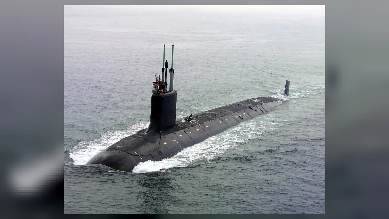
🏢 WorkplaceSubmarine control rooms hundreds of feet beneath dark ocean waves
⚡ Everyday Impact SparkPinpoints exact underwater coordinates across pitch-black ocean basins with zero windows or GPS
🤯 Mind-Blowing Fact • Grade 1
Beneath the ocean waves hide giant underwater mountain ranges taller than the Rockies—and submarine navigators steer safely through their valleys without ever seeing them with their eyes!
✨ Word Sparks (Grade 1 Glossary)
Tap 🔊 to hear
Submarine
A special vessel built to travel deep underwater
Periscope
Tall tube or camera peeking above ocean waves
Seabed
The rocky or sandy floor under the ocean
🪝
How do you steer a submarine deep underwater with no windows at all?
1
Diving Deep!
Whoooosh! Seawater fills special side tanks, and a sleek glides down beneath the blue waves. Inside, there are zero front windows! How do they know where to go? Ask the submarine navigator!
2
Listening and Mapping
Deep underwater, it is dark as midnight. Navigators read glowing maps of underwater hills and valleys so the sub stays safe.
3
Peeking Above Waves
Near the top of the sea, they raise a tall camera pole called a to check for ships above!
1. How many front windshields does a deep-diving naval submarine have?
2. What tool lets a submarine crew look above the waves while staying hidden just underwater?
🤯 Mind-Blowing Fact • Grade 2
Sound travels more than four times faster underwater than it does through air—around 3,300 miles per hour!
✨ Word Sparks (Grade 2 Glossary)
Tap 🔊 to hear
Sonar
Using underwater sound waves to find distance and objects
Submerge
To dive completely beneath the surface of water
Echo
A sound wave bouncing back off a surface
🪝
Why don't phone GPS maps work once a submarine dives underwater?
1
Where Radio Waves Stop
Ping! A soft sound pulse off a distant underwater cliff. High overhead, satellite GPS radio signals bounce right off salty ocean water and cannot reach deep below! That means a submarine navigator must track every single turn and speed change from the moment the sub dives.
2
Seeing With Sound
Just like dolphins and bats use to find their way in the dark, submarines use ''—short for Sound Navigation and Ranging. Sensitive hull microphones listen to ocean sounds and measure water depth beneath the keel.
3
Three-Dimensional Driving
Surface ships only steer left or right across waves, while submarine crews steer left, right, up, and down through deep ocean valleys!
1. Why can't a deeply submerged submarine just use satellite GPS all day?
2. Which marine animals use sound echoes in a way similar to submarine sonar?
🤯 Mind-Blowing Fact • Grade 3
In 1958, Submarine Navigator Shepherd Jenks guided the USS Nautilus on history's very first underwater voyage straight beneath the North Pole's frozen ice cap!
✨ Word Sparks (Grade 3 Glossary)
Tap 🔊 to hear
Gyroscope
Device sensing exact direction and tilt without outside views
Seamount
An underwater mountain rising up from the ocean floor
Bathymetry
Measuring and mapping depths of underwater ocean terrain
🪝
How can a submarine track its exact spot on Earth for weeks underwater without looking outside once?
1
Motion-Sensing Gyroscopes
Step into the quiet, softly glowing control room of a submarine cruising 400 feet beneath the Atlantic Ocean. Quartermasters and navigators watch digital sea-floor charts updated by a 'Ship's Inertial Navigation System.' Inside sealed cases, laser and motion sensors feel every tiny tilt, turn, and speed change—calculating exact position mile after mile!
2
Maps of Hidden Sea Mountains
Ocean bottoms are far from flat! Navigators carefully study 'bathymetric charts' that map deep canyons, flat plains, and tall underwater volcanic peaks called so the hull stays miles clear of rocks.
3
Diving With Ballast Tanks
To dive beneath the waves, vents open so heavy seawater floods outer ballast tanks. When it is time to surface, high-pressure air blows that water right back out so the submarine rises smoothly!
4
Sailing Under Polar Ice
Beneath the frozen Arctic North Pole, submarine navigators aim upward-pointing sonar beams to measure giant hanging ice ridges overhead and find open-water skylights called polynyas!
1. How does an Inertial Navigation System know where a submerged submarine has traveled?
2. What historic voyage did the submarine USS Nautilus complete in 1958?
🤯 Mind-Blowing Fact • Grade 4
On modern Virginia-class submarines, old-fashioned optical periscopes have been replaced by fiber-optic 'photonics masts' controlled with an ergonomic joystick controller!
✨ Word Sparks (Grade 4 Glossary)
Tap 🔊 to hear
Passive Sonar
Listening silently to ocean sounds without sending pings
Quartermaster
Naval navigation specialist plotting charts and voyage data
Photonics Mast
Fiber-optic camera pole replacing traditional mirror periscopes
🪝
Why do naval submarines stay quiet instead of pinging loud sonar echoes like movies show?
1
Passive vs. Active Sonar
Action movies love playing dramatic 'PING!' sound effects every five seconds, yet real U.S. Navy submarines homeported in Norfolk, Virginia—the largest naval station on Earth—almost never ping! Broadcasting loud 'active sonar' reveals a submarine's own location for dozens of miles through water. Instead, submarine navigators and sonar teams rely on silent '' hydrophones alongside precision seabed contour charts and internal laser gyroscopes.
2
Norfolk and Newport News Heritage
Coastal Virginia stands right at the heart of American submarine engineering: master shipbuilders in Newport News construct advanced Virginia-class submarines, while Navigation Officers and enlisted guide them safely out past bustling Chesapeake Bay merchant ships and bridge-tunnels into the deep Atlantic Ocean.
3
Photonics Masts Replace Old Periscopes
Newest submarines no longer even poke glass-mirror tubes through their thick steel pressure hulls! Instead, telescoping '' raise high-definition color cameras, thermal night-vision sensors, and a split-second GPS receiver above the waves—sending crisp video down thin fiber-optic cables to wide control-room screens.
4
Deep-Sea Research Submersibles
Beyond naval defense, civilian submarine navigators pilot scientific research submersibles like Woods Hole's Alvin—guiding oceanographers safely down miles of pitch-black ocean water to map glowing deep-sea creatures, coral canyons, and volcanic hydrothermal vents!
1. Why do real naval submarines rarely send out loud 'active sonar' pings?
2. How does a modern 'photonics mast' differ from a classic periscope?
🤯 Mind-Blowing Fact • Grade 5
Submarine ring-laser gyroscopes are so astonishingly sensitive that they can detect Earth's slow 15-degree-per-hour daily rotation—and even tiny local shifts in gravity caused by dense underwater volcanic mountains!
✨ Word Sparks (Grade 5 Glossary)
Tap 🔊 to hear
Accelerometers
Precision sensors measuring tiny changes in speed and motion
Thermocline
Ocean layer where water temperature drops sharply with depth
Neutral Buoyancy
Balanced weight matching water so a sub neither sinks nor rises
🪝
How do submarine navigators combine ring-laser Sagnac interferometry, Newtonian double integration, and gravity anomalies to navigate stealthily for months?
1
Blindfolded Across Abyssal Plains
Imagine piloting a 7,800-ton submerged vessel at over twenty knots through pitch-black abyssal mountain passes hundreds of meters deep—with zero front windows, zero satellite radio signals, and zero active radar emissions. Submarine Navigation Officers ('Navs') and their enlisted Quartermaster teams accomplish this three-dimensional feat continuously across global ocean basins and beneath shifting Arctic pack ice.
2
Ring-Laser Gyroscopes and Newtonian Calculus
At the core of a modern Ship's Inertial Navigation System (SINS) sit three perpendicular ring-laser or electrostatic gyroscopes paired with ultra-sensitive micro-g . Exploiting Albert Einstein's relativistic Sagnac effect, counter-rotating laser beams inside a triangular quartz block detect angular rotation down to thousandths of a degree per hour. Dedicated onboard computers execute nonstop Newtonian calculus—integrating measured acceleration once over time to derive three-axis velocity, and integrating velocity a second time to compute exact latitude, longitude, and depth!
3
Thermoclines, Salinity, and Neutral Buoyancy
Ocean water is layered like a dense liquid atmosphere: sharp vertical jumps in water temperature ('') and salt concentration ('haloclines') alter both hull buoyancy and how acoustic sound waves bend underwater. Navigators and Diving Officers pump seawater between variable trim tanks to hold razor-steady while cross-checking electromagnetic speed logs and protected 'water-space management' corridors.
4
Bathymetric Terrain Matching and Deep Submergence
Both naval submarines and full-ocean-depth scientific submersibles descending 10,900 meters into the Mariana Trench compare narrow-beam downward echo soundings and subtle seabed gravitational pull variations against high-resolution digital bathymetric maps—correcting even tiny gyroscope drift without ever surfacing.
5
Training Submarine Officers and Quartermasters
Naval navigators complete rigorous university STEM degrees, graduate-level nuclear propulsion physics training, and the Submarine Officer Basic Course in Groton, Connecticut—earning coveted silver or gold 'Dolphin' pins signifying mastery of every life-support, buoyancy, and navigation system aboard.