⚡ Everyday Impact SparkProtects millions of acres of healthy trees, clean streams, and safe trails for wildlife and campers
🤯 Mind-Blowing Fact • Grade 1
Counting the light and dark rings inside a fallen tree trunk tells a ranger the exact number of years that tree grew!
✨ Word Sparks (Grade 1 Glossary)
Tap 🔊 to hear
trail
a marked dirt path through the woods
campfire
a safe outdoor fire built at camp
sapling
a young slender tree growing up tall
🪝
Who takes care of millions of tall forest trees and helps campers stay safe in the woods?
1
Boots on the Pine Trail
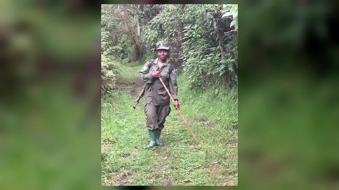
Crunch, crunch! Sturdy boots step over pine cones on a shady mountain path. Wearing a wide hat and green badge, a friendly guardian checks tall oaks and pines.
2
Watching Over Woods and Streams
Clear streams bubble past mossy rocks. Rangers clear fallen branches off , plant baby trees, and make sure are out cold.
3
Helping Campers and Bears
They remind hikers to lock snacks in bear-safe boxes. Clean woods keep deer, owls, and visiting families happy!
1. Why do rangers ask campers to store food inside bear-safe boxes?
2. What must campers always make sure before leaving a campfire ring?
🤯 Mind-Blowing Fact • Grade 2
Smokey Bear became the famous symbol of wildfire safety in 1944, and six years later rangers rescued a real bear cub in New Mexico!
✨ Word Sparks (Grade 2 Glossary)
Tap 🔊 to hear
lookout
a high tower built to spot smoke
compass
a magnetic tool pointing north for navigation
canopy
high leafy roof formed by tall treetops
🪝
How can a ranger peek at a tree's age and health without ever chopping the tree down?
1
An Outdoor Office Under Giant Trees
Morning mist rises off pine-covered ridges as a pickup truck climbs a gravel mountain road. Instead of sitting inside four walls all day, rangers patrol vast state and national woodlands on foot, horseback, or kayak to protect trees, streams, and wildlife.
2
Checking Tree Health and Fire Towers
Using a small hollow tool that pulls out a pencil-thin straw of wood, rangers read growth rings without hurting the living tree! They also watch dry summer ridges from high towers and weather stations to spot smoke early.
3
Safe Trails for Everyone
After big windstorms, crews saw fallen logs off hiking paths, repair wooden footbridges, and guide lost hikers using and satellite maps.
1. How do rangers check a living tree's age without cutting it down?
2. Why were high lookout towers built on mountain peaks?
🤯 Mind-Blowing Fact • Grade 3
Some pine trees—like lodgepole and table mountain pines—seal their cones with natural resin that only melts open in the warmth of a forest fire!
✨ Word Sparks (Grade 3 Glossary)
Tap 🔊 to hear
watershed
land area draining rainwater into shared rivers
invasive
non-native pest or plant harming local habitats
erosion
washing or blowing away of bare soil
🪝
Wait—why would a trained ranger sometimes start a gentle, low fire on purpose to keep a forest healthy?
1
Balancing a Living Ecosystem
Step beneath towering hemlocks and white oaks in Virginia's George Washington and Jefferson National Forests, where sunlight dapples mossy boulders. Managing millions of acres of public woodland takes science! Rangers monitor soil , stream cleanliness, and beetles like the emerald ash borer that threaten native trees.
2
Helpful Fire and New Seedlings
Surprisingly, not all fire harms a woodland! On cool, calm days with careful planning, trained crews guide slow, low 'prescribed burns' across the forest floor. Clearing out thick dead brush prevents giant summer megafires, returns nutrients to the soil, and even pops open certain pine cones that need warmth to drop seeds!
3
Watersheds That Fill City Taps
Healthy tree roots act like giant natural sponges. When heavy mountain rain falls, forest soils filter mud and pollution before clear water flows into rivers that supply drinking water to towns downstream.
4
Leave No Trace Stewardship
Whether repairing Appalachian Trail switchbacks, checking fishing licenses, or rescuing injured hawks, rangers teach visitors 'Leave No Trace' habits so wild places thrive for centuries.
1. Why do rangers sometimes lead carefully planned 'prescribed burns'?
2. How do healthy forest tree roots help towns and cities miles downstream?
🤯 Mind-Blowing Fact • Grade 4
More than sixty million Americans drink clean tap water that begins its journey as rain and snow filtered through U.S. National Forests!
✨ Word Sparks (Grade 4 Glossary)
Tap 🔊 to hear
silviculture
the science of growing healthy forest trees
stewardship
responsible care of nature for future generations
indicator
a sensitive species showing overall habitat health
🪝
How do foresters balance clean water, wildlife habitats, outdoor recreation, and sustainable timber across 193 million acres of public land?
1
Gifford Pinchot and Conservation History
At the dawn of the twentieth century, runaway logging had stripped whole mountain ranges bare, triggering muddy floods downriver. In 1905, President Theodore Roosevelt and America's first Chief Forester, Gifford Pinchot, established the U.S. Forest Service to care for public woodlands wisely across generations. Today, rangers steward 193 million acres of national forests and grasslands—including over 1.6 million acres stretching along Virginia's Blue Ridge and Allegheny mountains.
2
Silviculture and Satellite Mapping
Modern rangers blend rugged backcountry skills with —the science of growing and tending diverse forest stands. Using Geographic Information Systems (GIS), drone cameras, and increment borers, they map tree canopy density, track fungal blights or bark-beetle outbreaks, and replant native chestnuts, oaks, and spruces after storms.
3
Protecting Headwater Streams and Rare Species
More than sixty million Americans get their tap water from streams originating in national forests! Rangers test stream dissolved oxygen and survey cold-water brook trout and rare Shenandoah salamanders—amphibians that serve as living of clean air and unpolluted mountain mist.
4
Multiple-Use Public Stewardship
Unlike strictly untouched nature preserves, state and national forests balance 'multiple uses': wilderness hiking trails, campgrounds, wildlife corridors, watershed protection, and carefully regulated sustainable timber harvests. By enforcing laws against poaching and illegal dumping while coordinating backcountry rescues, rangers ensure public lands remain healthy and welcoming to all.
1. Which president worked with Gifford Pinchot in 1905 to launch the U.S. Forest Service?
2. Why do rangers closely study brook trout and mountain salamanders?
🤯 Mind-Blowing Fact • Grade 5
Living trees and deep forest soils across the United States absorb and lock away more than ten percent of America's total carbon dioxide emissions every single year!
✨ Word Sparks (Grade 5 Glossary)
Tap 🔊 to hear
dendrochronology
studying tree rings to date past climates
sequestration
capturing and storing carbon safely in nature
serotinous
cones opening to release seeds after heat
🪝
How do modern forest scientists use airborne LiDAR lasers, dendrochronology, and carbon-flux models to safeguard woodlands in a changing climate?
1
Applied Ecology Across Public Landscapes
Spanning 154 national forests, twenty national grasslands, and hundreds of state forestry districts, professional foresters and District Rangers oversee complex terrestrial ecosystems shaped by geology, hydrology, and human history. Guided by the Multiple-Use Sustained-Yield Act and the National Forest Management Act, rangers balance biodiversity conservation, carbon , clean headwater hydrology, outdoor recreation, and sustainable wood-product renewal without depleting ecological capital.
2
LiDAR Canopy Scanning and Dendrochronology
Gone are the days when timber cruising relied solely on tape measures and compasses. Today's forestry specialists analyze airborne LiDAR (Light Detection and Ranging), firing hundreds of thousands of laser pulses per second from survey aircraft to build three-dimensional maps of canopy height, understory biomass, and hidden landslide scars beneath dense foliage. On the ground, dendrochronologists examine microscopic xylem vessels inside increment cores to reconstruct centuries of drought cycles, insect defoliations, and historic fire intervals.
3
Fire Ecology and Fuel-Load Restoration
Decades of twentieth-century total fire suppression unintentionally allowed shade-tolerant brush and ladder fuels to crowd sun-loving oak-hickory and ponderosa pine savannas, turning mild surface fires into destructive crown fires. Certified as Burn Bosses, senior rangers calculate fuel moisture percentages, Keetch-Byram drought indices, and atmospheric mixing heights before igniting low-intensity prescribed burns that recycle soil phosphorus, stimulate fire- cones, and restore resilient mosaic habitats.
4
Forest Pathology and Invasive Species Defense
Global trade has introduced non-native pests—such as the hemlock woolly adelgid and emerald ash borer—that lack natural predators in North American woods. Rangers collaborate with entomologists and geneticists to release targeted biological controls, breed blight-resistant American chestnut hybrids, and enforce firewood quarantines that halt pest transport across county lines.
5
Carbon Sinks, Watersheds, and Civic Trust
Every year, U.S. forests absorb and store more than ten percent of the nation's annual carbon dioxide emissions inside living wood and deep humic soils while filtering drinking water for 180 million citizens across 3,400 communities—making the ranger's daily fieldwork an essential pillar of planetary and civic resilience.