1. How do both sleet and freezing rain usually begin high up in winter clouds?
2. Which one bounces off your winter jacket like tiny clear beads?
🤯 Mind-Blowing Fact • Grade 2
Just half an inch of heavy freezing rain can add 500 pounds of extra ice weight onto a single power line span!
✨ Word Sparks (Grade 2 Glossary)
Tap 🔊 to hear
wedge
a slanted slice pushed between two layers
refreeze
freeze solid again after melting into liquid
ice storm
a winter storm bringing thick freezing rain
🪝
How can warm air hide above your head while your nose feels freezing cold on the ground?
1
A Winter Sky Sandwich
Step outside on a gray January day when the thermometer by your door reads 28 degrees Fahrenheit, yet liquid rain is falling! High above the cold ground, a of warmer air has slid overhead like filling inside a sandwich.
2
Deep Cold Makes Sleet
Snowflakes drift out of high clouds and melt into raindrops inside that warm middle layer. When a deep blanket of freezing air sits underneath, those raindrops in midair into tiny bouncing balls of sleet.
3
Shallow Cold Makes Freezing Rain
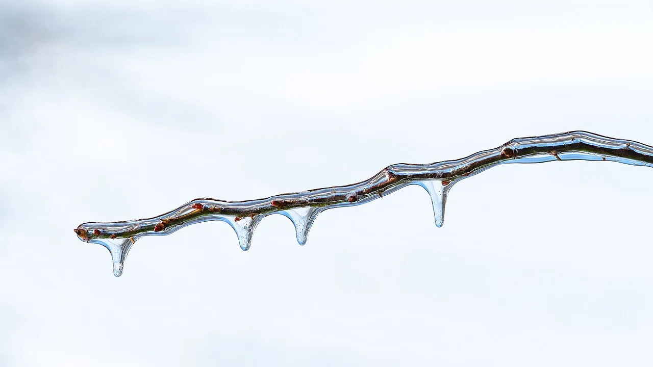
When the freezing air near the ground is very thin, raindrops stay liquid all the way down and freeze instantly onto icy sidewalks and trees!
1. What makes falling winter snowflakes turn into raindrops partway down from the cloud?
2. Why is freezing rain usually much more slippery and dangerous than sleet?
🤯 Mind-Blowing Fact • Grade 3
Meteorologists tell sleet and hail apart easily: hail grows upward inside summer thunderstorms, while sleet falls downward through winter cold layers!
✨ Word Sparks (Grade 3 Glossary)
Tap 🔊 to hear
ice pellet
official weather term for bouncing winter sleet
glaze
smooth, clear ice coating formed by freezing rain
weather balloon
helium balloon carrying sensors through sky layers
🪝
How can two towns just twenty miles apart get crunchy sleet in one yard and slick glaze ice in the next?
1
Four Winter Cousins
During a winter storm, tiny shifts in sky temperature decide whether your neighborhood gets fluffy snow, crunchy sleet, slick freezing rain, or plain cold rain! launched into winter clouds map out invisible layers of warm and cold air to solve the puzzle.
2
Why Warm Air Rides on Top
Cold air is denser and heavier than warm air, so it hugs valleys and plains like syrup. When a winter storm pulls milder air northward from the ocean or Gulf of Mexico, that lighter warm air glides right up over the cold ground air, creating a temperature inversion.
3
Sleet: Frozen Before Touchdown
If the warm nose overhead partially or fully melts falling snow, and the subfreezing layer below is at least several thousand feet thick, drops refreeze in midair into translucent five-millimeter called sleet.
4
Freezing Rain: Supercooled Glaze
If the warm layer is thick and the freezing ground layer is shallow, drops chill below 32 degrees Fahrenheit without freezing—until they touch cold twigs or pavement and lock into clear !
1. Why does milder ocean air slide over top of freezing winter air instead of pushing underneath it?
2. How is winter sleet different from summer hail?
🤯 Mind-Blowing Fact • Grade 4
Partially melted snowflakes help create sleet much faster than completely melted raindrops because leftover microscopic ice bits act as instant starter seeds for refreezing!
✨ Word Sparks (Grade 4 Glossary)
Tap 🔊 to hear
cold-air damming
dense freezing air trapped against mountain slopes
radiosonde
instrument package carried aloft by weather balloons
warm nose
above-freezing layer jutting over cold surface air
🪝
Why are Virginia's Piedmont and Shenandoah Valley among America's classic battlegrounds for sleet and freezing rain?
1
Cold-Air Damming Against the Mountains
Ask any Virginia meteorologist about tricky winter forecasts, and you will hear three famous words: ! When an Arctic high-pressure system parks over New England, chilly northeast winds funnel dense subfreezing air southward along the eastern slopes of the Appalachian and Blue Ridge Mountains. Trapped against the mountain wall like water behind a dam, that stubborn shallow wedge of freezing surface air refuses to budge even as milder Atlantic storm winds ride overhead!
2
Comparing Vertical Temperature Profiles
Forecasters study vertical temperature graphs from weather balloons to draw town-by-town winter maps. Where the entire sky column stays below 0 degrees Celsius, pristine snow falls. Ten miles east, a shallow '' near 1,500 meters partially melts snowflakes, leaving tiny ice cores that rapidly refreeze inside a 1,000-meter subfreezing layer below as noisy, bouncing sleet.
3
Supercooled Drops and Instant Glaze
Twenty miles farther east, the warm layer deepens to +4 degrees Celsius, melting every ice crystal completely! With zero ice nuclei left inside, falling raindrops enter a shallow 400-meter freezing surface layer and become supercooled liquid. Upon striking a 28-degree tree limb or overpass, a fraction freezes instantly while the rest spreads into crystal-clear glaze ice.
4
Why Bridges Ice Before Highways
Elevated bridges expose both their top deck and underside to freezing air while solid earth warms regular roads from beneath, making overpasses glaze over first!
1. How does 'cold-air damming' along the Blue Ridge and Appalachian Mountains set up freezing rain?
2. Why do highway bridges and overpasses freeze faster during freezing rain than regular roads?
🤯 Mind-Blowing Fact • Grade 5
Completely melted raindrops have lost their starter ice crystal seeds, so they often refuse to refreeze in midair at -4°C—falling as supercooled freezing rain instead of bouncing sleet!
✨ Word Sparks (Grade 5 Glossary)
Tap 🔊 to hear
overrunning
warm moist air gliding up over cold surface air
nucleation
starting of ice freezing around a tiny seed
bright band
strong radar echo marking where falling snow melts
🪝
Why does completely melting a snowflake aloft make freezing rain much more likely than sleet—even in subfreezing ground air?
1
Thermodynamic Soundings and Frontal Overrunning
Along a winter warm front or coastal nor'easter, buoyant maritime tropical air glides upward over a dense continental polar air mass—a synoptic process called frontal . Plotting radiosonde temperature soundings against altitude reveals a classic elevated thermal inversion: subfreezing air above 3,000 meters where dendritic snow crystals grow, an above-freezing 'warm nose' between roughly 800 and 2,500 meters, and a subfreezing boundary layer hugging the ground.
Here lies a fascinating microphysical twist! If the warm nose is modest (+1°C to +3°C), falling snowflakes melt only ~80 to 90 percent, retaining a tiny microscopic ice core. Upon re-entering subfreezing air below, that residual ice seed triggers immediate refreezing into translucent ice pellets (METAR code PL, called sleet in the United States). Conversely, if the warm nose exceeds +3°C over a deep layer and melts every trace of ice, pure liquid raindrops lack efficient ice nuclei and rarely freeze spontaneously until temperatures plunge below minus 10°C—so they fall right through a minus-4°C surface layer as supercooled freezing rain (FZRA)!
3
Latent Heat Limits Ice Accretion Rates
When supercooled drops strike a subfreezing twig or power cable, freezing releases 334 joules per gram of latent heat. Subfreezing wind and evaporation must carry that released heat away so the remaining water film solidifies into dense, transparent glaze ice (~0.9 grams per cubic centimeter).
4
Self-Limiting Warming vs. Cold Advection
Ironically, heavy freezing rain can warm surface air toward 0°C via released latent heat—unless brisk northerly cold-air advection continually replenishes subfreezing air, sustaining catastrophic ice storms like the 1998 North American event.
5
Dual-Pol Melting-Layer Detection
Modern operational forecasters track the exact altitude of the melting layer in real time via a vivid dual-polarization radar ring called the ',' sharpening winter road and power-grid warnings to within kilometers.