1. What does an urban planner use to organize where parks, homes, and roads belong?
2. Why do urban planners talk with families and neighbors?
🤯 Mind-Blowing Fact • Grade 2
Savannah, Georgia, was planned in 1733 around 24 shady green public squares so every neighborhood had a park just steps away!
✨ Word Sparks (Grade 2 Glossary)
Tap 🔊 to hear
Zone
A city area set aside for homes, shops, or parks
Transit
Buses, trains, and subways that carry many riders
Crosswalk
Painted street stripes where walkers cross safely
🪝
Why shouldn't a noisy, smoky factory be built right next door to an elementary school?
1
Thinking Like a City Puzzle-Solver
Imagine building an entire busy town out of colorful wooden blocks! Where would you place the sunny playground, the grocery store, the fire station, and the train depot? Urban planners solve real-life neighborhood puzzles like this for towns and cities every day.
2
Smart Rules for Land
Planners group city land into helpful so loud factories stay far away from quiet homes, hospitals, and schools. They also map safe , protected bike lanes, and bus routes so families can travel easily without big traffic jams.
3
Looking Years Ahead
Communities grow and change every year. Urban planners count how many new families are moving in so towns build enough clean water pipes, shade parks, and bright classrooms.
1. Why do urban planners divide a city into different zones?
2. What helps people travel across a busy city without everyone driving separate cars?
🤯 Mind-Blowing Fact • Grade 3
Using thermal satellite maps, urban planners discovered that tree-lined streets can be up to 10 degrees Fahrenheit cooler in summer than bare asphalt blocks!
✨ Word Sparks (Grade 3 Glossary)
Tap 🔊 to hear
GIS
Computer mapping software that stacks layers of city data
Mixed-Use
Neighborhoods blending homes, shops, and parks together
Master Plan
A city's long-term guide for future growth
🪝
How do cities prepare today for thousands of people who will live there twenty years from now?
1
Zooming Out to See the Whole City
While an architect designs a single building, an urban planner zooms way out to organize how entire neighborhoods fit together. Picture looking down from an airplane window at crisscrossed bridges, riverfront trails, apartment buildings, and train lines—every single connection takes careful teamwork and planning.
2
Digital Layers on GIS Maps
Modern planners use Geographic Information Systems, or , to stack colorful map layers on a wide computer screen. One digital layer shows river flood zones, another shows school bus stops, and a third reveals which sidewalks need more shade trees.
3
Walkable Neighborhoods
Many planners design '' town centers where bakeries, libraries, apartments, and playgrounds sit within an easy ten-minute walk. Wider sidewalks, curb ramps, and protected bike lanes help children and grandparents move around safely.
4
Town Hall Teamwork
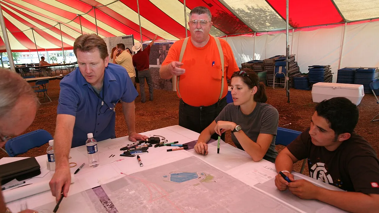
At lively evening community workshops, planners listen to ideas from students, families, shopkeepers, and mayors before city councils vote on long-term for future decades.
1. How is an urban planner's job different from an architect's job?
2. What can a planner spot by stacking flood-zone and street layers in GIS?
🤯 Mind-Blowing Fact • Grade 4
Arlington, Virginia's decades-long 'Rosslyn-Ballston Metro Corridor' plan is studied by urban planners worldwide because it doubled jobs and homes while keeping car traffic on local roads remarkably steady!
✨ Word Sparks (Grade 4 Glossary)
Tap 🔊 to hear
Infrastructure
Essential city systems like roads, pipes, bridges, and transit
Heat Island
A paved city area noticeably warmer than nearby countryside
Sprawl
Spread-out building growth across wide stretches of land
🪝
What transforms a congested sprawl of highways into a vibrant town where everything you need is minutes away?
1
Balancing Growth, Nature, and Infrastructure
Listen to the morning rhythm at a well-planned commuter rail plaza: electric trains glide smoothly into the station, cyclists lock bikes under covered racks, and students cross tree-shaded brick crosswalks toward school. Behind that effortless daily choreography stands decades of foresight by urban planners who balance population growth, environmental conservation, and public budgets.
2
Transit-Oriented Development
When cities endlessly outward across farms and forests, residents spend hours idling in highway traffic. To solve this challenge, planners champion Transit-Oriented Development—clustering apartments, offices, health clinics, libraries, and grocery stores within a five-to-ten-minute walk of rail and rapid-bus stations. For example, Arlington County, Virginia, famously channeled taller mixed-use buildings along five underground Metro stations while preserving quiet, tree-lined single-family neighborhoods just blocks away.
3
Cooling Urban Heat Islands
Acres of dark rooftops and black asphalt parking lots absorb intense summer sunlight, creating 'urban ' several degrees hotter than nearby countryside. Planners partner with civil engineers and urban foresters to expand street-tree canopies, protect stream buffers, and encourage green roofs that cool city air and soak up heavy rain.
4
Civic Democracy in Action
Because land-use choices shape everyone's daily life, urban planners host open neighborhood forums, survey families, and present clear, data-backed choices to elected city councils and county boards.
1. What is the main goal of Transit-Oriented Development?
2. How do urban planners help reduce the 'urban heat island' effect?
🤯 Mind-Blowing Fact • Grade 5
More than 55 percent of humanity now lives in urban areas—and by 2050, planners will help design sustainable cities for nearly 7 out of every 10 people on Earth!
✨ Word Sparks (Grade 5 Glossary)
Tap 🔊 to hear
Demographics
Statistical data about population size, age, and growth
Ordinance
An official local law passed by a city or town
Complete Streets
Roadways designed safely for walkers, cyclists, transit, and drivers
🪝
How do urban planners use demographic forecasting, spatial data, and civic policy to guide metropolises housing millions of residents?
1
Choreographing the Modern Metropolis
Every thriving metropolitan region functions like a living, interconnected organism: pressurized water mains pulse beneath boulevards, freight and commuter rail lines circulate goods and workers, and connected park greenways act as green lungs filtering air particulates and stormwater. Urban and regional planners synthesize , economics, environmental geography, and municipal law to guide how communities evolve across 20- to 50-year horizons.
2
Historical Roots of City Planning
Planned street grids date back millennia—from ancient Indus Valley drainage avenues and Roman civic forums to Pierre L'Enfant's 1791 ceremonial plan for Washington, D.C. Modern urban planning crystallized during the late Industrial Revolution, when smoky, overcrowded tenements beside coal-fired factories sparked severe public-health crises. Reformers introduced municipal zoning , greenway park systems, and underground transit corridors to restore sunlight, clean air, and sanitation.
3
Spatial Analytics and Complete Streets
Contemporary planners analyze U.S. Census population projections, commuter origin-destination matrices, and multi-layered GIS terrain models. Moving past mid-twentieth-century designs focused solely on high-speed car throughput, cities nationwide now adopt '' frameworks—re-engineering avenues with high-visibility crosswalks, wheelchair-accessible islands, protected bicycle tracks, dedicated Bus Rapid Transit lanes, and shade canopies.
4
Climate Resilience and Equitable Housing
Coastal and riverine communities—such as Virginia's Hampton Roads region—confront rising tidal levels and stronger cloudbursts. Planners update floodplain zoning, convert vulnerable shorelines into absorbent waterfront parks, and craft inclusionary housing policies near major job centers so teachers, nurses, firefighters, and service workers can afford to live in the towns they serve.
5
Building Democratic Consensus
Trained in accredited university urban planning programs and certified by the American Institute of Certified Planners (AICP), these civic strategists translate complex spatial and economic data into transparent, long-range master plans shaped by open public participation.