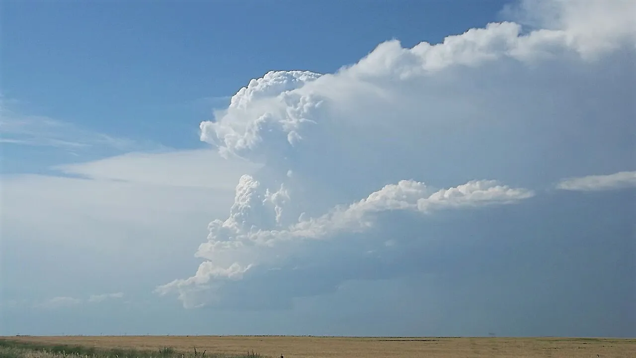
1. What special feature makes a supercell different from an ordinary thunderstorm?
2. How do weather scientists spot a spinning supercell miles away to warn towns?
🤯 Mind-Blowing Fact • Grade 2
A single long-lived supercell thunderstorm can travel more than 200 miles over four to six hours!
✨ Word Sparks (Grade 2 Glossary)
Tap 🔊 to hear
fuel
warm, moist air that powers a storm
tilt
lean at a slant instead of straight up
alert
a safety warning sent before severe weather
🪝
Why do ordinary summer thunderstorms put themselves out in an hour while supercells roar across whole states?
1
Why Normal Storms Quit Early
In a regular afternoon thunderstorm, warm air rises straight up and heavy cold rain splashes straight back down through the middle. Soon that chilly rain smothers the rising warm air like water poured on a campfire!
2
Tilted and Spinning
A supercell solves that problem by tilting at an angle and spinning like a giant barber pole! Warm, humid spirals smoothly up one side while heavy rain and hail crash down miles away on the other side.
3
Rarest and Strongest
Fewer than one in ten thunderstorms become supercells, yet they produce nearly all baseball-sized hail and strong tornadoes—making early weather super helpful!
1. Why doesn't heavy cold rain put out a supercell's warm updraft?
2. Roughly how long can a powerful supercell thunderstorm keep going?
🤯 Mind-Blowing Fact • Grade 3
Meteorologist Keith Browning coined the word 'supercell' in 1962 after studying an enormous rotating hailstorm over Wokingham, England!
✨ Word Sparks (Grade 3 Glossary)
Tap 🔊 to hear
mesocyclone
giant rotating updraft inside a supercell storm
wind shear
winds changing speed and direction with height
hook echo
curved radar shape wrapping around storm rotation
🪝
How do winds blowing at different speeds turn an invisible rolling tube of air into a towering corkscrew storm?
1
Meet the Mesocyclone
Look up at a towering cloud base carved with spiral grooves like stacked seashells slowly turning overhead! Deep inside that supercell spins a two-to-six-mile-wide column of rising air called a .
2
Step One: Invisible Rolling Pin
How does a cloud start spinning? The secret is —winds changing speed and direction with height! When ground breezes blow slow from the south while upper winds scream fast from the west, air near the ground starts rolling horizontally like an invisible rolling pin.
3
Step Two: Tipping It Upright
When a booming bubble of sun-warmed, humid air punches upward through that horizontal rolling tube, it bends the spinning tube straight up into the sky like a giant vertical corkscrew!
4
Spotting the Hook Echo
On Doppler weather radar screens, rain wrapping around the spinning often paints a curved '' that alerts forecasters to watch closely for tornadoes.
1. What creates the invisible horizontal spinning tube of air before a supercell tips it upright?
2. What famous curved radar pattern warns meteorologists that rain is wrapping around a spinning mesocyclone?
🤯 Mind-Blowing Fact • Grade 4
Low-Precipitation (LP) supercells on the High Plains are so transparent that they can drop softball-sized hailstones onto sunny grass miles away from any visible rain curtain!
✨ Word Sparks (Grade 4 Glossary)
Tap 🔊 to hear
wall cloud
lowered rotating cloud beneath a rain-free base
inflow
warm humid air rushing in to feed storms
velocity scan
radar view showing wind speed toward or away
🪝
Why do storm spotters look for a lowered 'wall cloud' under the rain-free base of a supercell?
1
Anatomy of Earth's Most Organized Storm
Even though supercells make up only a small fraction of thunderstorms from the Great Plains to Virginia, they command top attention from meteorologists because their internal architecture works like a finely tuned turbine! Powered by strong instability and deep vertical wind shear, a supercell sustains a rotating mesocyclone 3 to 10 kilometers wide with corkscrew updrafts surpassing 150 kilometers per hour—strong enough to suspend grapefruit-sized hailstones and punch overshooting tops deep into the lower stratosphere.
2
Rain Core, Vault, and Wall Cloud
Looking at a classic supercell from the southeast reveals sharp visual zones. Downwind to the north and east pours a blinding curtain of torrential rain and large hail called the forward-flank downdraft. Back toward the southwest sits a dark, flat rain-free cloud base where warm, humid rushes smoothly upward. Beneath that rain-free base, cool humid air pulled in from the rain zone condenses lower down to form a boxy, rotating lowering called a —the exact spot where tornadoes most often develop!
3
Three Flavors of Supercells
Forecasters group supercells into three styles: Classic supercells balanced with vivid radar hook echoes; Low-Precipitation (LP) supercells along dry High Plains borders that look like sculpted corkscrew skeletons dropping giant hail in nearly clear air; and High-Precipitation (HP) supercells common in humid eastern states like Virginia that wrap heavy rain curtains around their rotation.
4
Doppler Velocity Saves Lives
Because rain curtains in HP supercells can hide a tornado from human eyes, Doppler radar —measuring wind blowing toward and away from the dish—give communities life-saving advance warnings day or night!
1. Why are High-Precipitation (HP) supercells in humid eastern states especially tricky for visual storm spotters?
2. What cloud feature hanging beneath a supercell's rain-free base marks where warm inflow meets cooled air?
🤯 Mind-Blowing Fact • Grade 5
Updrafts inside extreme supercells shoot upward so fast—over 110 mph—that cloud droplets don't have time to grow into radar-visible rain until miles high, leaving an empty 'vault' hole on radar screens!
✨ Word Sparks (Grade 5 Glossary)
Tap 🔊 to hear
vorticity
measure of local spinning motion in fluid air
helicity
corkscrew motion combining wind spin and inflow
tornadogenesis
physical process that births a tornado
🪝
How does a spinning supercell generate an upward vacuum pump strong enough to lift air that isn't even warm?
1
Streamwise Vorticity and Storm-Relative Helicity
What elevates an ordinary cumulonimbus into a multi-hour supercell is a precise marriage of thermodynamic instability (high CAPE) and strong vertical wind shear—typically 20 to 30+ meters per second of vector wind difference across the lowest 6 kilometers! As surface winds veer clockwise with height (say, southeasterly at the ground, southwesterly at 1.5 kilometers, and fast westerly aloft), horizontal spin known as aligns parallel to the storm's inflow. Meteorologists quantify this corkscrew fuel as Storm-Relative (SRH); tilting that streamwise vorticity vertically births a towering cyclonic mesocyclone.
2
Dynamic Pressure Perturbations: The Vacuum Effect
Once a mesocyclone spins fiercely aloft, fluid dynamics unlocks an astonishing second engine! Just like water swirling down a drain creates low pressure along its core, rapid cyclonic rotation mid-storm creates an intense dynamic low-pressure zone overhead. That upward pressure-gradient force acts like a giant skyward vacuum cleaner—sucking sub-cloud air upward at violent speeds even through stable capping layers where thermal buoyancy alone would fail!
3
Storm Splitting: Right-Movers and Left-Movers
Upward tilting of a horizontal vortex tube actually creates two opposite spins at first: a cyclonic (counterclockwise) updraft on the southern flank and an anticyclonic (clockwise) updraft on the northern flank! Vertical wind-shear pressure forces split the storm in two, steering the cyclonic 'right-mover' southward into richer warm inflow where it thrives.
4
FFD, RFD, and Tornadogenesis
Even with a vigorous mesocyclone miles overhead, fewer than 20 to 25 percent of supercells spawn tornadoes! requires a delicate balance between the forward-flank downdraft (FFD) and a surge of descending air behind the storm called the rear-flank downdraft (RFD) that arches spin down to ground level without being too icy cold to lift back into the updraft.
5
Bounded Weak Echo Regions on Dual-Pol Radar
Inside the fiercest supercells, updrafts exceed 50 meters per second—blasting air upward so rapidly that raindrops and hailstones don't even have time to form near the core, carving a hollow radar 'vault' called a Bounded Weak Echo Region (BWER)!