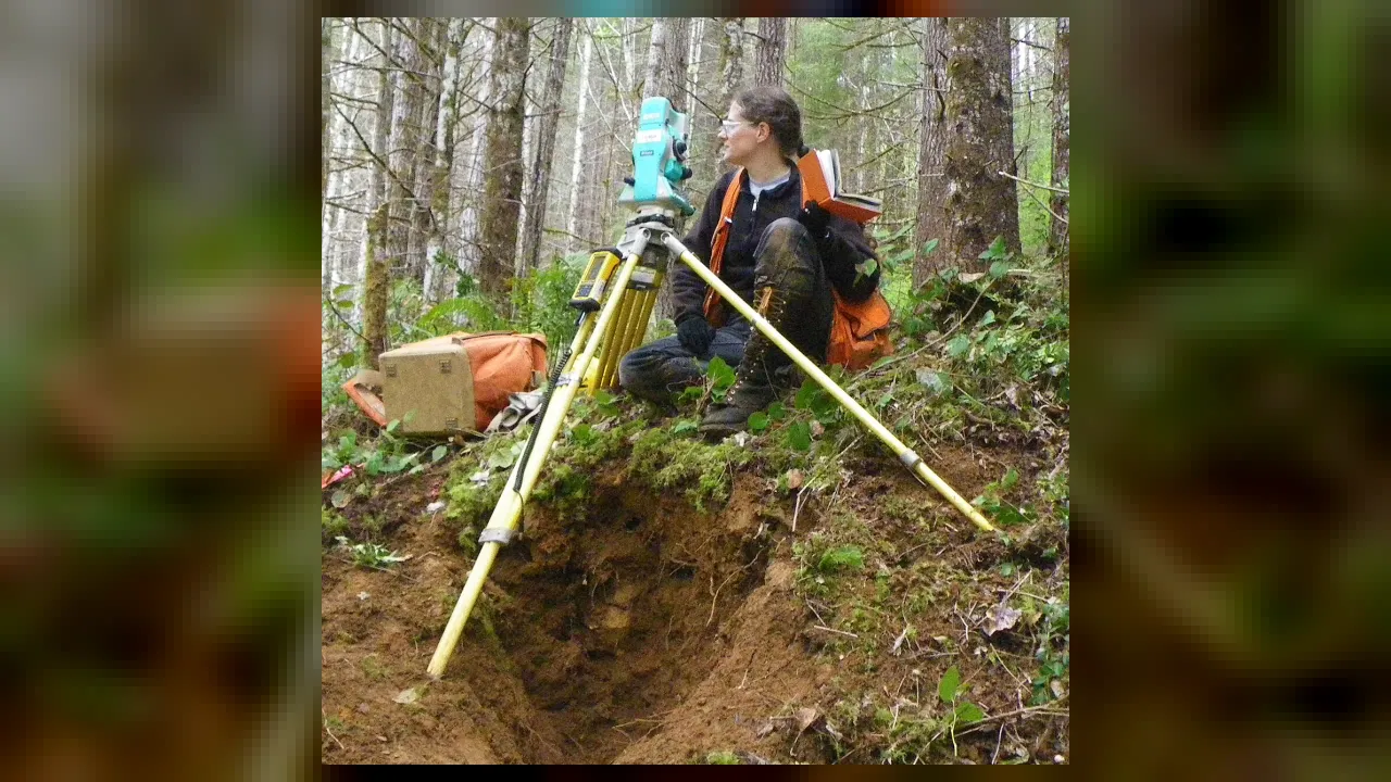
👷 CAREERS
💼 Civil Engineering, Geomatics & Land Measurement
VA Economics, Civics & Career Readiness SOL K.8, 1.8, 2.8, 3.9
Surveyor
Measuring Earth With Lasers and Math
Grade 4 • Expanding • 189 words
🧭 Career FieldCivil Engineering, Construction, Cartography & Land Law
🛠️ Key Tools & SkillsRobotic total stations, yellow tripod levels, GPS/GNSS satellite receivers, prism poles, and boundary deeds
🏢 WorkplaceForests, highway construction sites, city streets, mountain ridges, and CAD mapping offices
⚡ Everyday Impact SparkPinpoints exact property lines, road grades, and bridge heights down to fractions of an inch before a single shovel digs
🤯 Mind-Blowing Fact • Grade 1
Young George Washington worked as a land surveyor in Virginia when he was just sixteen years old!
✨ Word Sparks (Grade 1 Glossary)
Tap 🔊 to hear
Surveyor
Expert who measures land for maps and builders
Tripod
Sturdy stand with three legs
Boundary
Exact edge line around a piece of land
🪝
Who wears a bright vest and peeks through a yellow camera on three legs?
1
Measuring the Land
Beep, blink, measure! Have you seen someone by the road with a tall three-legged stand? That worker is a . Surveyors measure hills, yards, and streets.
2
Beams of Light
Their yellow machine sends a safe beam of light to a shiny mirror pole. Flash! In one blink, it tells how far away the pole stands.
3
Ready to Build
put bright flags in the grass to mark exact spots. Builders use those marks so new schools, parks, and bridges fit just right!
1. Why does a surveyor set up a yellow tool on a tripod before builders start digging?
2. Which famous American leader worked as a young land surveyor in Virginia?
🤯 Mind-Blowing Fact • Grade 2
Surveyors place permanent metal disks called benchmarks in rock and concrete so anyone can check exact elevation above sea level!
✨ Word Sparks (Grade 2 Glossary)
Tap 🔊 to hear
Benchmark
Permanent metal disk marking exact land height
Prism
Special mirror target that bounces laser beams
Elevation
Height of a place above sea level
🪝
How do builders digging a tunnel from opposite sides of a mountain meet right in the middle?
1
Drawing Lines Across the Earth
Set the tripod steady and check the bubble level! Before a playground, highway, or tunnel is built, a land surveyor maps every hill, dip, and corner. Without surveyors, fences might cross into a neighbor's yard and bridges might not line up.
2
Lasers and Satellites
Surveyors bounce invisible laser beams off a special glass held by a helper—or tracked automatically by robot! They also use tall satellite antennas that talk to space to pinpoint exact spots on Earth.
3
Brass Markers Under Your Feet
Next time you walk across a park or bridge, look down at the sidewalk. You might spot a round brass disk stamped by surveyors to mark exact height above the sea!
1. What is a round brass disk set into stone by surveyors to mark height above sea level called?
2. What two high-tech helpers do modern surveyors use to measure long distances?
🤯 Mind-Blowing Fact • Grade 3
Three of the four presidents carved onto Mount Rushmore—George Washington, Thomas Jefferson, and Abraham Lincoln—worked as land surveyors!
✨ Word Sparks (Grade 3 Glossary)
Tap 🔊 to hear
Total station
Tripod machine measuring angles and laser distances
Coordinates
Numbers showing an exact spot on maps
Deed
Official legal record describing who owns land
🪝
How can an old handwritten map mentioning a 'white oak tree' help a modern surveyor find a property corner?
1
Half Explorer, Half Mathematician
Crunch through autumn leaves in sturdy boots, tablet in one hand and tripod slung over one shoulder! Land surveyors split their week between outdoor fieldwork and computer mapping offices, measuring three-dimensional positions across cities, farms, and forests.
2
Total Stations and Angles
A surveyor's signature tripod instrument is called a . It measures both horizontal and vertical angles while timing an infrared laser pulse bouncing back from a corner-cube prism, calculating exact using geometry.
3
Historical Detective Work
When homeowners need to know where one yard ends and another begins, surveyors research courthouse written decades or centuries ago. They follow compass bearings, metal pins buried underground, and stone piles to retrace original boundaries fairly.
4
Guiding Big Construction
On construction sites, surveyors stake out exact elevations so storm pipes slope smoothly downhill and skyscraper steel columns rise straight and true.
1. What two measurements does a total station combine to pinpoint a spot on the ground?
2. Why do surveyors visit county courthouses and read old property deeds?
🤯 Mind-Blowing Fact • Grade 4
A traditional surveyor's chain is exactly 66 feet long—and 80 chains equal one mile, which is also why a cricket pitch is still 66 feet long today!
✨ Word Sparks (Grade 4 Glossary)
Tap 🔊 to hear
Geomatics
Modern science of gathering and mapping Earth data
Triangulation
Using triangle angles to calculate unknown distances
Topographic
Map style showing hills, valleys, and elevations
🪝
How did early surveyors measure miles across rugged Virginia mountains using heavy metal chains?
1
From Gunter's Chains to Geomatics
In colonial Virginia, young surveyors like George Washington and Peter Jefferson—Thomas Jefferson's father—hiked across rivers and ridges carrying brass magnetic compasses and sixty-six-foot iron chains of one hundred links. Ten square chains equaled exactly one acre! Today that historic profession has evolved into , uniting trigonometry, satellite physics, and computer-aided drafting to map everything from neighborhood subdivisions to Chesapeake Bay shorelines.
2
Trigonometry in Action
How do you measure the width of a rushing river without swimming across? Surveyors use . By measuring one baseline along the riverbank and sighting precise angles to a boulder on the opposite shore, basic triangle math calculates the exact river span.
3
Topographic Contours and Drainage
Before civil engineers design a school campus or highway interchange, surveyors record thousands of ground heights to build a map. Looping contour lines connect points of equal elevation, showing steep cliffs where lines crowd close together and gentle meadows where lines spread wide apart.
4
Millimeter Precision Underground and Overhead
When giant tunnel-boring machines chew beneath busy harbors or suspension-bridge towers rise miles apart, surveyors account for steel thermal expansion in summer sun and even the gentle curve of Earth itself so concrete and steel decks meet within millimeters.
1. How can a surveyor find the distance across a wide canyon without crossing it?
2. On a surveyor's topographic map, what do closely packed contour lines indicate?
🤯 Mind-Blowing Fact • Grade 5
On New York's Verrazzano-Narrows Bridge, surveyors had to account for Earth's curvature because the tops of its two 693-foot towers stand 1 and 5/8 inches farther apart than their bases!
✨ Word Sparks (Grade 5 Glossary)
Tap 🔊 to hear
Geodesy
Science measuring Earth's exact shape and gravity
Point cloud
Millions of laser dots forming 3D models
Cadastral
Relating to official legal land boundary surveys
🪝
Why must surveyors building a long suspension bridge factor in both Earth's curvature and shifting tectonic plates?
1
Geodesy and the True Shape of Earth
For small backyard fences, pretending Earth is a flat geometric plane works fine. Over miles of high-speed rail or bridge spans, however, Earth's curve drops roughly eight inches in the first mile—and two tall bridge towers standing plumb to gravity actually tilt slightly away from each other at their peaks! Licensed surveyors apply , modeling our planet not even as a smooth sphere, but as an oblate ellipsoid and gravity-shaped geoid.
2
Robotic Total Stations and Real-Time Kinematic GNSS
Modern field crews deploy motorized robotic total stations that lock onto a 360-degree prism carried by a single surveyor, measuring angles to one arc-second—equivalent to the width of a dime over two miles away! Simultaneously, dual-frequency GNSS receivers track signals from GPS, Galileo, and GLONASS satellite constellations. By pairing a roving antenna with a stationary base station, Real-Time Kinematic corrections cancel atmospheric delays to achieve centimeter-level coordinates.
3
Terrestrial LiDAR Point Clouds
Inside complex highway interchanges, historic cathedrals, or industrial plants, surveyors mount terrestrial laser scanners that fire up to two million laser pulses per second. The rebounding pulses assemble a dense, three-dimensional '' capturing every bolt, beam, and curb with millimeter fidelity.
4
Cadastral Law and Retracement Ethics
Boundary—or —surveying carries binding legal authority. Licensed Professional Land Surveyors weigh an established legal hierarchy of evidence: natural monuments like rivers and ridgelines outrank artificial iron pipes or concrete markers, which in turn outrank written compass bearings, distances, and area totals, resolving neighborhood disputes fairly.
5
Monitoring Our Dynamic Planet
Beyond construction layout and property law, geodetic surveyors operate continuous satellite reference stations that monitor millimeter tectonic shifts along fault lines, measure hydroelectric dam deformation, chart underwater harbor channels with sonar, and track coastal sea-level change to keep communities resilient.