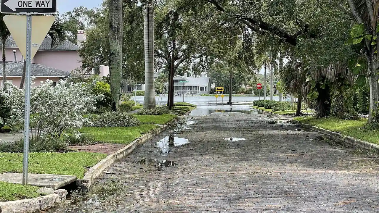
🌋 Where It FormsShallow Continental Shelves, Bays, Estuaries, and Coastlines
💎 Key PropertiesRising Dome of Seawater • Can Exceed 15 to 28 Feet Above Normal Tide
⚡ Planet Earth SparkFierce storm winds pile billions of tons of ocean water onto beaches and coastal towns
🤯 Mind-Blowing Fact • Grade 1
One single cubic yard of seawater weighs nearly as much as a small family car!
✨ Word Sparks (Grade 1 Glossary)
Tap 🔊 to hear
surge
A sudden, powerful forward rush of water
inland
Away from the coast toward higher land
seawater
Salty water from the ocean
🪝
What happens if you blow hard across a bowl of soup—and what if a giant storm does that to the sea?
1
Pushing Up the Sea
Blow across a full cup of water and watch it pile up on the far side! Giant ocean storms push the very same way. That rising ocean water is called storm .
2
Higher Than Normal Waves
Strong winds shove huge amounts of salty water onto dry beaches and roads. Waves ride right on top of the high water.
3
Move to High Ground
Weather helpers warn coastal towns days before the sea rises. Families travel to higher ground until the ocean goes back down!
1. What is the main force that pushes a storm surge onto the beach?
2. What do coastal families do when a big storm surge warning is announced?
🤯 Mind-Blowing Fact • Grade 2
Healthy coastal wetlands and mangrove forests can shrink storm surge height by several inches for every mile of marsh the water crosses!
✨ Word Sparks (Grade 2 Glossary)
Tap 🔊 to hear
dome
A wide, rounded mound shape
tide
Daily rise and fall of ocean water
wetland
Marshy coastal land soaked with water
🪝
How is a storm surge different from a sudden earthquake tsunami?
1
A Gradual Dome of Water
Picture an ocean storm spinning toward the coast like a giant fan. Hour after hour, howling winds shove surface water toward shore. Instead of arriving as one single giant curling wave, storm surge swells upward like a wide, rising of ocean water.
2
Storm Surge Plus High Tide
Every day, gravity from the Moon and Sun creates regular high and low . When a storm surge arrives at the exact same time as high tide, the combined water level is called a storm tide, flooding streets even deeper.
3
Nature's Coastal Shields
Salt marshes, mangrove trees, and tall sand dunes act like natural sponges and bumpers. They slow down rushing seawater and help protect homes behind the beach!
1. What do weather scientists call the total water height when storm surge combines with normal tide?
2. How do sand dunes, marshes, and mangrove trees help coastal towns?
🤯 Mind-Blowing Fact • Grade 3
Hurricane winds cause about ninety-five percent of a storm surge's height, while low air pressure inside the eye lifts the sea by only a tiny fraction!
✨ Word Sparks (Grade 3 Glossary)
Tap 🔊 to hear
continental
Belonging to the edge of a continent
estuary
Coastal bay where river meets salty sea
inundation
Depth of floodwater covering normally dry land
🪝
Why does a shallow ocean floor make storm surge climb much higher than a deep seafloor?
1
Deep Sea vs. Shallow Shelf
Out in the deep open ocean, hurricane winds push surface water forward, yet the water beneath can circulate downward and flow back out to sea. Because it has room to escape underneath, storm surge in deep water stays only two or three feet high. Everything changes when that storm reaches a gently sloping, shallow coastline!
2
Trapped Against the Coast
Along shallow shelves like the Gulf of Mexico or near the mouth of the Chesapeake Bay, pushed water hits the rising sandy bottom and has nowhere to go except up and inland. Funnel-shaped bays squeeze that water even higher, flooding miles of flat coastal land.
3
Wind vs. Low Pressure
Many people guess low air pressure inside a hurricane sucks the ocean upward. In reality, low pressure adds only about five percent of the height, while relentless wind pushing water accounts for roughly ninety-five percent!
4
Reading Surge Maps
Before hurricanes strike, forecasters share color-coded maps showing how many feet deep water could stand above dry ground in each neighborhood.
1. Why do shallow coastlines build much taller storm surges than steep, deep coastlines?
2. Roughly how much of a storm surge is driven by wind compared to low air pressure?
🤯 Mind-Blowing Fact • Grade 4
During Hurricane Katrina in 2005, storm surge along the shallow Mississippi coastline reached nearly twenty-eight feet above normal sea level—the highest ever recorded in U.S. history!
✨ Word Sparks (Grade 4 Glossary)
Tap 🔊 to hear
quadrant
One of four quarters of a circle
fetch
Open water distance wind blows without obstacles
nor'easter
Coastal storm with strong northeast ocean winds
🪝
Why does the right-front side of a landfalling hurricane in Virginia or Florida push the highest wall of water?
1
Counterclockwise Spin and the Right-Front Quadrant
Look down from a weather satellite at a Northern Hemisphere hurricane approaching the Atlantic or Gulf Coast. Because of the Coriolis effect, winds whirl counterclockwise around the center eye. On the storm's right-front side relative to its forward track, screaming eyewall winds blow directly onshore—and the hurricane's forward motion adds right on top of that wind speed! Meanwhile, winds on the left side blow offshore, sometimes pushing harbor water out to sea.
2
Nor'easters Surge Too
Hurricanes are not the only storms that flood coastlines. During autumn and winter, sprawling low-pressure systems called churn off Virginia's Hampton Roads and Outer Banks. Even with weaker peak winds than hurricanes, a slow-moving nor'easter can blow onshore across hundreds of miles of ocean—a distance called —piling high storm tides through three or four consecutive tidal cycles.
3
Battering Waves on Top
Rising water is doubly powerful because dense saltwater weighs roughly sixty-four pounds per cubic foot. Worse still, breaking ocean waves ride atop the elevated storm tide, battering piers, boardwalks, and dunes normally far out of reach.
4
SLOSH Computer Models
National Hurricane Center specialists run a supercomputer model named SLOSH—Sea, Lake, and Overland Surges from Hurricanes—running thousands of virtual storm tracks to issue life-saving Storm Surge Warnings.
1. Which section of a landfalling Northern Hemisphere hurricane usually drives the highest onshore storm surge?
2. Why can a winter nor'easter cause major coastal flooding even with slower winds than a major hurricane?
🤯 Mind-Blowing Fact • Grade 5
In 1899, Cyclone Mahina drove an extraordinary storm surge of roughly thirteen meters (over forty-two feet) into funnel-shaped Bathurst Bay in northeastern Australia!
✨ Word Sparks (Grade 5 Glossary)
Tap 🔊 to hear
bathymetry
Measurement of underwater ocean depths and shapes
hydrodynamic
Force created by heavy water in motion
attenuate
Reduce the force, height, or energy
🪝
How do bathymetry, wind stress, Ekman transport, and coastline geometry turn ocean storms into twenty-foot coastal floods?
1
Fluid Mechanics of Wind Setup and the Inverted Barometer
Oceanographers divide storm surge generation into two physical mechanisms: wind setup and the inverted barometer effect. Every 1-hectopascal drop in central atmospheric pressure allows surrounding air to push sea level up by roughly 1 centimeter inside the cyclone core—meaning even an extreme 920-hectopascal hurricane gains less than 1 meter from low pressure alone. Wind stress ($\tau \propto \rho_{air} C_d v^2$), however, transfers tremendous momentum to the upper ocean. In the Northern Hemisphere, Coriolis deflection—known in oceanography as Ekman transport—steers wind-driven water 90 degrees to the right of winds blowing parallel to shore, piling a broad dome of water against coastal barriers even before landfall.
2
Bathymetry and Concave Bays
Underwater topography, or , governs how high that dome grows. Over steep island shelves such as Puerto Rico or Hawaii, deep water permits subsurface return currents that cap storm surge at 1 to 2 meters, though towering breaking surf still strikes cliffs. Conversely, wide, gently sloping continental shelves—like West Florida, Louisiana, or the Bay of Bengal—create bottom friction that traps water against the coast. Funnel-shaped bays such as Tampa Bay, Chesapeake Bay, or New York Harbor further amplify surge heights by compressing incoming volume into narrowing channels.
3
Hydrodynamic Force of Saltwater
With a density of approximately 1,025 kilograms per cubic meter, seawater exerts immense hydrostatic and forces. A modest 60-centimeter surge moving at just a few meters per second can float vehicles and scour sand from beneath foundation pilings, while superimposed wind waves deliver repetitive impact loads.
4
Probabilistic Forecasting With P-Surge
Because a 20-kilometer shift in a hurricane's eye track can swing a bay from offshore drainage to peak onshore inundation, NOAA runs ensembles of hundreds of SLOSH simulations called P-Surge to map worst-case flooding above ground level (AGL).
5
Living Shorelines and Engineered Barriers
Modern coastal resilience blends Dutch-style movable storm-surge gates—like New England's hurricane barriers and Venice's MOSE system—with 'living shorelines' of restored oyster reefs, salt marshes, and barrier islands that wave energy sustainably.