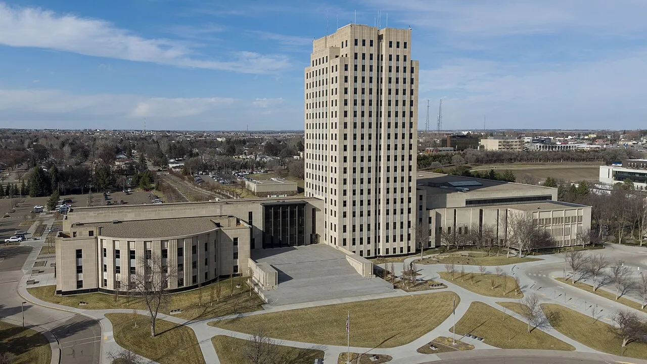
2. Which city is the state capital of North Dakota?
🤯 Mind-Blowing Fact • Grade 2
North Dakota farmers and busy bees produce more golden honey every year than any other state in America!
✨ Word Sparks (Grade 2 Glossary)
Tap 🔊 to hear
interpreter
Helper translating words between two different languages
canyon
Deep steep valley carved by flowing water
shuffle
Mix papers so nobody knows the order
🪝
Why did President Benjamin Harrison cover up two statehood papers and shuffle them like cards?
1
Friends on the Northern Plains
Watch wild horses and shaggy bison trot past colorful striped in the western Badlands! North Dakota takes its friendly name from the Dakota word for 'allies,' and fields of spring wheat, honey clover, and sunflowers stretch to the horizon.
2
Sacagawea Joins the Journey
During the snowy winter of 1804–1805, Lewis and Clark built wooden Fort Mandan near present-day capital city Bismarck. There they met young Shoshone Sacagawea, who guided their expedition safely toward the Pacific!
3
A Twin Statehood Surprise
On November 2, 1889, President Benjamin Harrison covered the titles and shuffled North and South Dakota's papers before signing—so neither twin could brag about being first! Alphabetically, North Dakota is listed thirty-ninth.
1. Who joined the Lewis and Clark Expedition at Fort Mandan in North Dakota during the winter of 1804–1805?
2. Why did President Benjamin Harrison shuffle the statehood proclamations on November 2, 1889?
🤯 Mind-Blowing Fact • Grade 3
Theodore Roosevelt National Park in North Dakota is the ONLY national park in America named directly after one single person!
✨ Word Sparks (Grade 3 Glossary)
Tap 🔊 to hear
conservation
Protecting wild lands, water, and animals wisely
plateau
Wide area of high, mostly level ground
pothole
Small prairie pond left behind by glaciers
🪝
How did ranching in North Dakota's rugged Badlands inspire a future president to protect America's wild places?
1
Three Giant Prairie Steps
Travel west across North Dakota and climb three wide natural steps! Along the eastern border lies the pancake-flat Red River Valley, once the bottom of an enormous Ice Age lake. Next rises the rolling Drift Prairie dotted with duck ponds, followed by the high Missouri and rugged Badlands.
2
Earth-Lodge Villages and Fort Mandan
Mandan, Hidatsa, and Arikara farmers lived in warm dome-shaped earth lodges along the Missouri River, trading corn with Lakota, Dakota, and Chippewa neighbors. Welcomed by Mandan chiefs during the bitter winter of 1804–1805, Lewis and Clark teamed up with Sacagawea at Fort Mandan.
3
Roosevelt in the Badlands
In the 1880s, young New Yorker Theodore Roosevelt moved to cattle ranches along the Little Missouri River. Falling in love with open western skies later inspired President Roosevelt to conserve millions of acres of national parks and forests!
4
Peace Garden State
Admitted November 2, 1889, with its capital at Bismarck, North Dakota honors border harmony at the International Peace Garden.
1. Why is eastern North Dakota's Red River Valley some of the flattest, richest farmland in the world?
2. How did North Dakota's Badlands influence young Theodore Roosevelt?
🤯 Mind-Blowing Fact • Grade 4
Unlike almost every other major river in the United States, the Red River along North Dakota's eastern border flows straight NORTH toward Canada's Lake Winnipeg and Hudson Bay!
✨ Word Sparks (Grade 4 Glossary)
Tap 🔊 to hear
butte
Steep-sided isolated hill with a flat top
durum
Hard golden wheat ground to make pasta
migratory
Traveling north and south with changing seasons
🪝
Why do migratory ducks, pasta makers, and historians of the American West all treasure North Dakota?
1
Glacial Lake Agassiz to Painted Canyons
Across 70,698 square miles at the exact geographic center of North America, North Dakota steps upward from east to west. In the east, the Red River of the North flows unusually northward toward Canada across the flat, black-earth bed of prehistoric Lake Agassiz around Fargo and Grand Forks. Centrally, thousands of shallow glacial wetlands in the 'Prairie Pothole Region' hatch half of North America's wild ducks! West of the Missouri River and capital city Bismarck, wind and rain carve multicolored clay, sandstone, and baked red 'scoria' rising to White Butte (3,506 feet).
2
Mandan Trade Hub and Corps of Discovery
Long before Europeans arrived, the Knife River villages of the Mandan, Hidatsa, and Sahnish (Arikara) peoples formed one of North America's busiest Indigenous trade centers, exchanging flint, horses, shells, and garden crops with Lakota, Dakota, and Plains Ojibwe nations. Spending 146 winter days at Fort Mandan in 1804–1805—longer than at any other stop—Lewis and Clark relied on Mandan Chief Sheheke's hospitality and recruited teenaged Lemhi Shoshone guide Sacagawea.
3
Railroads, Twin Statehood, and America's Breadbasket
Northern Pacific rail tracks reached the Missouri River at Bismarck in 1873, bringing Norwegian, German-Russian, and Yankee homesteaders who planted hardy spring wheat. When Dakota Territory split in two on November 2, 1889, President Benjamin Harrison shuffled the unsigned documents before proclaiming North and South Dakota states together.
4
Conservation and Modern Energy
Honoring Theodore Roosevelt's Elkhorn Ranch years in the Badlands and U.S.-Canadian friendship at the 2,339-acre International Peace Garden, North Dakota leads the nation in pasta wheat, sunflowers, honey, flaxseed, and wind-and-prairie energy.
1. Why do biologists call North Dakota's Prairie Pothole Region the 'Duck Factory of North America'?
2. In what unusual direction does the Red River of the North flow along the North Dakota-Minnesota border?
🤯 Mind-Blowing Fact • Grade 5
Red rock layers capping North Dakota's Badlands—locally called 'scoria'—were naturally baked like brick kilns underground when lightning or prairie fires ignited ancient coal seams!
✨ Word Sparks (Grade 5 Glossary)
Tap 🔊 to hear
lacustrine
Formed on the bottom of ancient lakes
lignite
Soft brownish coal formed from ancient plants
kettle
Prairie pond formed where buried ice melted
🪝
How did prehistoric Lake Agassiz, Knife River diplomacy, and Little Missouri Badlands ranching make North Dakota pivotal to continental ecology, exploration, and conservation?
1
Three Physiographic Steps at the Continent's Heart
Encompassing 70,698 square miles—and containing the geographic center of the North American continent near Rugby—North Dakota rises westward across three distinct geomorphic terraces. Along the eastern border, the northward-flowing Red River of the North meanders across the ultra-flat plain left by Pleistocene Glacial Lake Agassiz, yielding world-renowned chernozem soils around Fargo. Climbing the Pembina and Missouri Coteau escarpments reveals the Drift Prairie's millions of wetlands—the Prairie Pothole 'duck factory'—before crossing the Missouri River trench into the unglaciated Missouri Plateau, where Little Missouri River erosion exposes Paleocene coal seams and terracotta-baked clinker ('scoria') across the Badlands up to 3,506-foot White Butte.
2
Three Affiliated Tribes, Oceti Sakowin, and Fort Mandan
For centuries at the confluence of the Knife and Missouri Rivers, the Mandan, Hidatsa, and Sahnish (Arikara)—today's Three Affiliated Tribes—engineered insulated timber-and-earth lodges, bred drought-hardy maize, and anchored a continental trade network linking Crow, Cheyenne, Ojibwe, and Oceti Sakowin (Lakota, Nakota, and Dakota) nations; northwards in the Turtle Mountains thrived Chippewa and Metis communities. During the subzero winter of 1804–1805, Meriwether Lewis and William Clark's Corps of Discovery built Fort Mandan near Washburn, surviving thanks to Mandan maize trade under Chief Sheheke and recruiting sixteen-year-old Lemhi Shoshone interpreter Sacagawea, whose linguistic skill, botanical knowledge, and calm presence with her infant son proved indispensable to reaching the Pacific.
3
Railroad Bonanza Farms and Shuffled 1889 Statehood
Following the Northern Pacific Railway's arrival at Bismarck in 1873 and huge mechanized 'bonanza' wheat farms in the Red River Valley, Norwegian, German-from-Russia, Icelandic, and eastern homesteaders settled the plains. When Congress divided Dakota Territory under the Enabling Act of 1889, President Benjamin Harrison deliberately obscured and shuffled the twin proclamations on November 2, 1889; by alphabetical convention, North Dakota took thirty-ninth place.
4
Elkhorn Ranch and the Birth of the Conservation Ethic
Grieving personal tragedy in 1884, twenty-five-year-old Theodore Roosevelt established the Maltese Cross and Elkhorn cattle ranches in the Little Missouri Badlands. Witnessing overgrazing and the near-extinction of Plains bison firsthand forged the conservation philosophy through which President Roosevelt later safeguarded 230 million acres of public lands—honored today at 70,446-acre Theodore Roosevelt National Park.
5
Agricultural Powerhouse, Peace Garden, and Energy Innovation
Dedicated in 1932 across the Manitoba border, the International Peace Garden celebrates the world's longest undefended frontier, while modern North Dakota leads U.S. production of spring and durum wheat, sunflowers, honey, canola, and flax alongside Bakken energy, wind turbines, and Garrison Dam water stewardship.