1. Which ocean did the Lewis and Clark Expedition finally reach in the West?
2. Who was the brave Shoshone woman who helped guide and translate for Lewis and Clark?
🤯 Mind-Blowing Fact • Grade 2
Lewis and Clark were so amazed by barking prairie dogs on the Great Plains that they shipped a live prairie dog in a cage all the way back to President Jefferson!
✨ Word Sparks (Grade 2 Glossary)
Tap 🔊 to hear
keelboat
Large wooden riverboat pushed by oars and poles
interpreter
Person who translates spoken words between two languages
species
Specific kind of living plant or animal
🪝
How did explorers draw maps and discover prairie dogs across eight thousand miles of wilderness?
1
Setting Out From Camp Wood
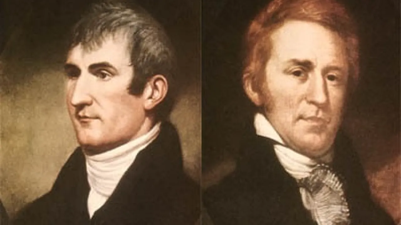
Picture pushing a fifty-five-foot wooden against the muddy current of the Missouri River in May 1804! Right after the Louisiana Purchase, President Thomas Jefferson chose Virginia officers Meriwether Lewis and William Clark to lead the Corps of Discovery west.
2
Sacagawea Joins the Journey
During their freezing first winter in North Dakota, Shoshone Sacagawea joined the crew while carrying her newborn son, Jean Baptiste. She rescued floating notebooks when a boat tipped, gathered wild roots, and helped trade for Shoshone horses to cross the snowy Rocky Mountains.
3
Ocean in View!
After reaching the Pacific Ocean in November 1805, the explorers returned safely to St. Louis with maps and sketches of nearly three hundred new plants and animals.
1. What official name was given to Lewis and Clark's exploration team?
2. How did Sacagawea help the expedition cross the steep Rocky Mountains?
🤯 Mind-Blowing Fact • Grade 3
When the Corps of Discovery voted on where to build their winter fort on the Pacific coast in November 1805, both Sacagawea and York—Clark's enslaved African American companion—cast equal votes alongside the soldiers!
✨ Word Sparks (Grade 3 Glossary)
Tap 🔊 to hear
headwaters
Small mountain streams where a big river begins
diplomacy
Building peaceful friendships and agreements between nations
cartography
The science and art of drawing accurate maps
🪝
What happened when Sacagawea looked at the Shoshone chief in the Rocky Mountains and realized he was her long-lost brother?
1
Jefferson's Four Big Goals
Rain pattered on canvas tents near St. Louis on May 14, 1804, as Captains Meriwether Lewis and William Clark steered their heavy keelboat up the Missouri River. President Thomas Jefferson gave his fellow Virginians four clear goals: map the new territory, search for an all-water Northwest Passage, build peaceful friendships with Native nations, and record unknown wildlife.
2
Winter at Fort Mandan
Rowing upstream across the Great Plains, the Corps of Discovery sketched pronghorn antelopes, grizzly bears, and bison herds. Welcomed by the Mandan and Hidatsa peoples during a forty-below-zero North Dakota winter, they hired fur trader Toussaint Charbonneau and his teenage Shoshone wife, Sacagawea.
3
Reunion in the Rockies
When Missouri ended at towering snowy peaks, the explorers urgently needed horses. Meeting a Shoshone band in August 1805, Sacagawea joyfully recognized Chief Cameahwait as the brother she had not seen since childhood—securing vital horses and mountain guides!
4
Pacific Waves and Safe Return
Aided by Nez Perce canoe-builders along the Columbia River, the crew wintered at Fort Clatsop on the Oregon coast before returning to St. Louis in September 1806.
1. Which Native American nation helped the tired expedition build dugout canoes after crossing the Bitterroot Mountains?
2. What historic vote took place near the Pacific coast in November 1805?
🤯 Mind-Blowing Fact • Grade 4
Out of the thirty-three permanent members of the Corps of Discovery across twenty-eight perilous months, only one soldier—Sergeant Charles Floyd—died, likely from appendicitis that no doctor in 1804 could have cured anywhere!
✨ Word Sparks (Grade 4 Glossary)
Tap 🔊 to hear
portage
Carrying boats and supplies overland past waterfalls
botany
Scientific study of plants, trees, and flowers
Continental Divide
Mountain ridge separating east-flowing and west-flowing rivers
🪝
How did two Virginia outdoorsmen, an enslaved hunter, and a teenaged Shoshone mother map 8,000 uncharted miles and bring almost everyone home alive?
1
Training in Science and Leadership
Months before France even offered all of Louisiana, President Thomas Jefferson selected his twenty-eight-year-old private secretary and fellow Albemarle County, Virginia, neighbor Meriwether Lewis to lead a western expedition. Lewis studied astronomy, , and medicine in Philadelphia, then invited his trusted former army commander William Clark to share equal co-captain rank over the thirty-three permanent members of the Corps of Discovery.
2
Up the Mighty Missouri
Departing Camp Dubois near St. Louis on May 14, 1804, the crew hauled a ten-ton keelboat and two pirogues 1,600 miles upstream to present-day North Dakota. Along the way, Clark's enslaved companion York proved indispensable as a skilled hunter, swimmer, and scout. Overwintering among hospitable Mandan and Hidatsa villages, the captains recruited French-Canadian trader Toussaint Charbonneau and his poised Shoshone wife Sacagawea, whose presence with baby Jean Baptiste immediately signaled to every tribe they met that the party traveled in peace, not war.
3
Portaging Waterfalls and Crossing the Divide
In summer 1805, after dragging canoes eighteen grueling miles around the Great Falls of the Missouri in Montana, the explorers discovered no easy water existed—the stretched into jagged, snow-choked Bitterroot peaks. Trading for horses with Sacagawea's brother Chief Cameahwait and recovering among the generous Nez Perce, they paddled down the Snake and Columbia Rivers to sight Pacific breakers in November 1805.
4
Scientific Treasure Trove
Welcomed back as heroes in St. Louis on September 23, 1806, Lewis and Clark delivered master maps, peaceful tribal notes, 178 newly described plants, and 122 newly cataloged animal species.
1. Why did Sacagawea's presence with her baby immediately help keep encounters peaceful with Native nations?
2. What geographic discovery dashed President Jefferson's hope for an easy all-water Northwest Passage?
🤯 Mind-Blowing Fact • Grade 5
William Clark's July 25, 1806, signature carved into sandstone at Pompeys Pillar along the Yellowstone River in Montana—named after Sacagawea's toddler son 'Pomp'—is still visible today as a National Monument!
✨ Word Sparks (Grade 5 Glossary)
Tap 🔊 to hear
sextant
Optical tool measuring star angles to find latitude
pirogue
Long, narrow flat-bottomed boat used on rivers
estuary
Wide river mouth where freshwater meets ocean tides
🪝
How did Jefferson's Enlightenment science project reshape American geography, biology, and the destiny of fifty Indigenous nations across the West?
1
Enlightenment Vision at Monticello
Long before Napoleon sold Louisiana, Thomas Jefferson dreamed of charting North America's interior from Mississippi headwaters to the Pacific Ocean. Securing a confidential $2,500 congressional appropriation in January 1803, Jefferson tapped fellow Virginian Captain Meriwether Lewis, tutoring him at Monticello before sending him to Philadelphia's leading scholars to master celestial navigation with , botanical preservation, and ethnographic observation. Sharing command equally with frontier cartographer William Clark, Lewis assembled the thirty-three-member Corps of Discovery.
2
Ascent of the Missouri Basin (1804–1805)
Setting forth from Camp Dubois opposite the mouth of the Missouri on May 14, 1804, aboard a fifty-five-foot keelboat and two open , the expedition ascended against swift, snag-filled currents across Missouri, Nebraska, and the Dakotas. Presenting Jefferson Peace Medals, the captains held councils with Oto, Yankton Sioux, Arikara, and Mandan leaders before erecting Fort Mandan near thriving earth-lodge trading towns larger than St. Louis. There they engaged Toussaint Charbonneau and sixteen-year-old Lemhi Shoshone interpreter Sacagawea, who gave birth to Jean Baptiste ('Pomp') in February 1805.
3
Over the Continental Divide
Dispatching the keelboat south in April 1805 laden with pressed flora, mineral specimens, and live magpies and prairie dogs for Monticello, the permanent party pressed westward into Montana. Sacagawea coolly scooped waterproofed journals and instruments from churning rapids during a May squall, identified Beaverhead Rock entering Shoshone homelands, and secured twenty-nine packhorses through an astonishing reunion with her brother, Chief Cameahwait. Enduring eleven freezing September days starving along the Lolo Trail across Idaho's Bitterroot Range, the corps survived thanks to Nimiipuu (Nez Perce) hospitality.
4
Fort Clatsop and Return Split
Descending the Clearwater, Snake, and Columbia Rivers in Ponderosa-pine dugouts, the expedition sighted the Pacific in November 1805—holding an unprecedented consensus vote including Sacagawea and Clark's enslaved outdoorsman York to construct Fort Clatsop on Oregon's south shore. On the 1806 return, Lewis explored Montana's Marias River while Clark charted the Yellowstone—where Clark carved his name on Pompeys Pillar, the sole physical inscription remaining along the trail.
5
Scientific Triumph and Continental Turning Point
Arriving in St. Louis on September 23, 1806, after 8,000 miles and over a million words of journals, Lewis and Clark documented 178 plant and 122 animal species new to Western science, bolstered U.S. claims to the Oregon Country, and opened trade corridors that forever altered Indigenous sovereignty across the West.