Introduction
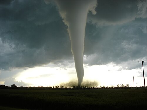
A tornado is a violently rotating column of air stretching from the base of a thunderstorm all the way to the ground. Although most tornadoes last less than 15 minutes, the strongest twisters generate the fastest surface winds on Earth!
An important word to know in this book is (SOO-per-sel). Supercell means: A powerful, long-lived thunderstorm with a deep, persistently rotating updraft (mesocyclone). Learning about Supercell helps us understand how How Tornadoes Form fits into Extreme Weather.
Key Features
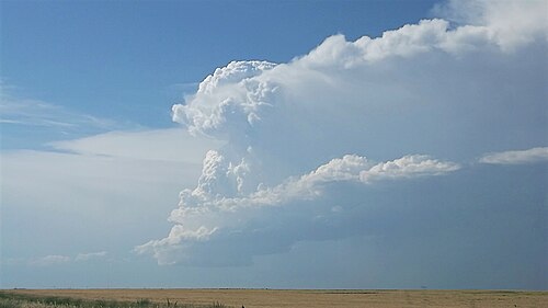
The fiercest tornadoes drop from giant rotating thunderstorms called supercells. In the central United States—"Tornado Alley"—warm, humid air from the Gulf of Mexico collides with cool, dry air from Canada and warm, dry air from the Rocky Mountains.
Scientists and explorers also look closely at (wind sheer), which means: A change in wind speed and direction at different altitudes that starts air rolling horizontally. These special traits make How Tornadoes Form easy to spot and study.
How It Works
When winds at different altitudes blow at different speeds and directions (), they create a horizontal spinning tube of air. A powerful rising current of warm air (an updraft) tilts that spinning tube vertically into a rotating mesocyclone. When a funnel cloud touches the ground, it officially becomes a tornado.
Here is another helpful term: (ee-ef skayl). It means: The Enhanced Fujita Scale (EF0 to EF5) used by meteorologists to rate tornado strength based on wind damage. Step by step, and EF Scale work together in nature.
In Our World
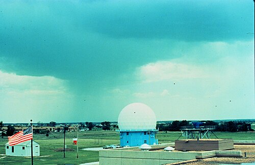
Meteorologists measure tornado damage using the Enhanced Fujita (EF) Scale from EF0 (light damage, 65–85 mph winds) to EF5 (incredible damage, winds over 200 mph). Doppler radar detects rotation inside clouds before a funnel even touches down, giving communities life-saving warning minutes.
Understanding how How Tornadoes Form works in our world also involves (wind sheer): A change in wind speed and direction at different altitudes that starts air rolling horizontally. Even when surrounding conditions shift across seasons or regions, the interaction between , Wind Shear, and helps sustain balance and resilience in the wider environment.
Amazing Facts
Amazing Fact #1: A tornado is actually invisible until it sucks up water droplets, dust, and debris that reveal its swirling funnel!
Amazing Fact #2: The fastest wind speed ever recorded on Earth—about 485 km/h (301 mph)—was measured by mobile Doppler radar inside a 1999 Oklahoma tornado.
Amazing Fact #3: When a tornado forms over a lake or the ocean, it sucks up a swirling column of water and spray called a waterspout.
Read & Review
Let's review what we discovered about How Tornadoes Form! In this book, we explored how , , and connect to Extreme Weather.
Key Question #1: When does a spinning funnel cloud officially become a tornado? Answer: When the rotating column of air reaches from the storm cloud all the way to the ground. A funnel cloud aloft becomes a tornado the moment its rotating winds make contact with the ground.
Key Question #2: What tool do meteorologists use to detect spinning winds inside a thunderstorm before a tornado touches down? Answer: Doppler weather radar. Doppler radar measures the velocity of raindrops moving toward and away from the radar dish to spot rotation.